


Aerial Imaging Market Size & Growth Forecast 2027–2036, By Segments (Imaging Type, Platform, Application, End-use), Regional Demand Trends (North America, Asia Pacific, Europe), Key Country Insights (U.S., Japan, South Korea, Germany, France, Italy), and Competitive Landscape
Market Size and Growth Outlook
Aerial Imaging Market size was around USD 5.96 Billion in 2026 and is slated to grow at 22.44% CAGR from 2027 to 2036, reaching USD 45.13 Billion by 2036. The industry revenue for 2027 is assessed at USD 7.14 Billion.
Base Year Value (2026)
USD 5.96 Billion
CAGR (2027-2036)
22.44%
Forecast Year Value (2036)
USD 45.13 Billion

Historical Data Period
2022-2026

Largest Region
North America

Forecast Period
2027-2036
Aerial Imaging Market Intelligence Snapshot:
-
Regional Market Dynamics:
- North America led in 2025 through extensive adoption across infrastructure, agriculture, construction, environmental monitoring, and defense, supported by advanced geospatial and remote sensing capabilities.
- Asia Pacific is growing rapidly as urbanization, infrastructure development, agricultural modernization, drone adoption, and smart infrastructure investments increase demand for aerial data.
-
Segment Momentum:
- Fixed-wing aircraft lead the market because they efficiently cover large geographic areas while delivering consistent image quality, making them well suited for mapping, environmental monitoring, agriculture, and national surveying projects.
- UAVs and drones are the fastest-growing platform segment due to their cost-effective deployment, high-resolution data collection, and ability to access challenging locations for inspection, disaster response, agriculture, and infrastructure monitoring.
-
Market Expansion Drivers:
- Rapid UAV adoption expanding commercial and defense aerial imaging applications
- Increasing disaster monitoring needs driving aerial imaging for emergency response
- Venture capital inflows accelerating AI-enabled drone imaging platform development
-
Leading Market Participants:
Leading players in the aerial imaging market include DJI Technology Co., Ltd. (China), AeroVironment Inc. (United States), EagleView Technologies Inc. (United States), Trimble Inc. (United States), Fugro N.V. (Netherlands), Nearmap Ltd (Australia), Planet Labs PBC (United States), Wingtra AG (Switzerland), DroneDeploy Inc. (United States), Hexagon AB (Sweden)
Global Market Forecast Snapshot:
-
Market Outlook:
- 2026 Market Size: USD 5.96 Billion
- 2027 Estimated Market Size: USD 7.14 Billion
- Projected Market Size: USD 45.13 Billion by 2036
- Growth Forecasts: 22.44% CAGR (2027-2036)
-
Regional and Segment Outlook:
- Leading Regional Market: North America
- High-Growth Regional Hub: Asia Pacific
- Core Revenue Segment: Oblique Imaging (Imaging Type) | Fixed-wing Aircraft (Platform) | Urban Planning (Application) | Government (End-use)
- Emerging Opportunity Segment: Oblique Imaging (Imaging Type) | UAV/Drone (Platform) | Disaster Management (Application) | Military & Defense (End-use)
Market Growth Drivers and Industry Trends
Rapid UAV adoption expanding commercial and defense aerial imaging applications
The increasing deployment of unmanned aerial vehicles across surveying, agriculture, infrastructure inspection, and defense operations is broadening the use of advanced imaging capabilities. The aerial imaging market growth is supported by rapid UAV adoption, as organizations leverage drone-based platforms to capture high-resolution visual data with improved accessibility and operational flexibility. Commercial operators are using aerial imaging solutions to monitor assets, map terrain, and support decision-making, while defense applications rely on drone imaging for surveillance, reconnaissance, and situational awareness.
Increasing disaster monitoring needs driving aerial imaging for emergency response
Natural disasters and emergency events are creating stronger demand for rapid assessment tools that can provide accurate information in difficult-to-access locations. The aerial imaging market is driven by the need for faster disaster monitoring solutions, where drone-based imaging supports damage evaluation, rescue coordination, and resource allocation during critical response periods. Emergency agencies and relief organizations are adopting aerial platforms to improve visibility of affected areas while reducing risks associated with manual inspection methods.
Venture capital inflows accelerating AI-enabled drone imaging platform development
Growing investor interest in artificial intelligence, autonomous systems, and drone technologies is encouraging innovation in next-generation imaging platforms. The aerial imaging market benefits from venture capital activity supporting AI-enabled solutions that improve image processing, automated analysis, and real-time data interpretation. Startups and technology developers are advancing intelligent drone platforms that combine imaging sensors with machine learning capabilities to deliver more efficient insights across commercial and industrial applications.
| Growth Driver Assessment Framework | |||||
| Growth Driver | Impact On CAGR | Regulatory Influence | Geographic Relevance | Adoption Rate | Impact Timeline |
|---|---|---|---|---|---|
| Rapid UAV adoption expanding commercial and defense aerial imaging applications | 2% | High | North America, Europe, Asia Pacific | High | Near Term |
| Increasing disaster monitoring needs driving aerial imaging for emergency response | 1.7% | High | Asia Pacific, Latin America | High | Near Term |
| Venture capital inflows accelerating AI-enabled drone imaging platform development | 1.6% | Low | North America | Emerging | Mid Term |
Unlock insights tailored to your business with our bespoke market research solutions - Click to get your customized report now!
Regional Demand Dynamics
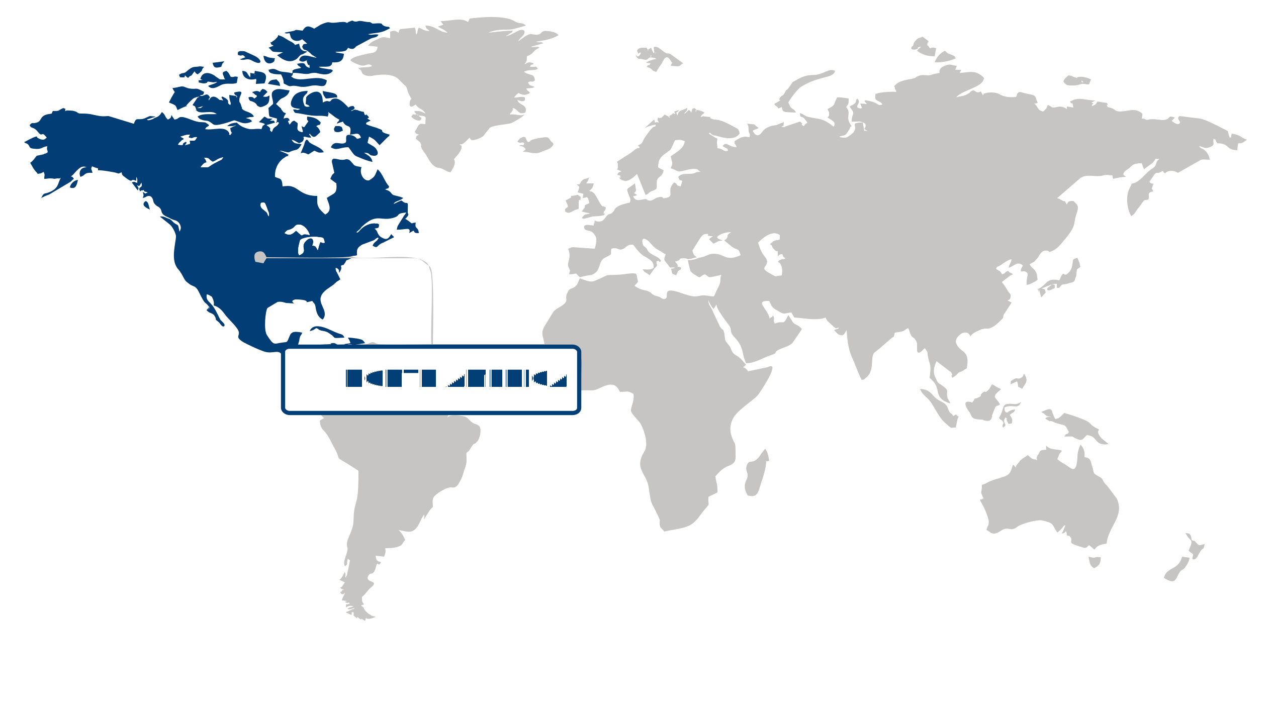
Largest Region
North America
Largest Market Share in 2026
North America (Largest Region) vs Asia Pacific (Fastest-Growing Region)
The aerial imaging market was led by North America in 2026, supported by extensive adoption of imaging technologies across infrastructure development, agriculture, environmental monitoring, construction, and defense applications. Advanced geospatial capabilities and growing use of aerial data for asset inspection, mapping, planning, and operational decision-making are strengthening regional demand. Continued integration of imaging with digital analytics and remote sensing technologies is also expanding the range of applications.
Asia Pacific is poised for the fastest growth as rapid urbanization, infrastructure development, and agricultural modernization increase the need for high-quality aerial data. Expanding use of drones and other aerial platforms for surveying, mapping, construction monitoring, and resource management is supporting adoption. Increasing investment in smart infrastructure and digital geospatial solutions is expected to further accelerate regional market development.
No card data available for this language/report.
Segment Leadership and Growth Trends
Imaging Type Segment Analysis: Oblique Imaging (Largest & Fastest-Growing Segment)
The oblique imaging segment dominated the aerial imaging market in 2026 and also represents the fastest-growing imaging type. Oblique imagery provides detailed side-angle perspectives of buildings, infrastructure, and landscapes, enabling more comprehensive visualization than traditional top-down imagery. Its growing adoption across urban planning, infrastructure management, real estate, public safety, and engineering applications is driven by the ability to generate highly detailed three-dimensional representations that improve planning, inspection, and asset management activities.
Platform Segment Analysis: Fixed-wing Aircraft (Largest Segment) vs UAV/Drone (Fastest-Growing Segment)
Fixed-wing aircraft held the largest share of the aerial imaging market in 2026. These platforms are widely used for covering extensive geographic areas efficiently while maintaining consistent image quality and operational stability. Their suitability for large-scale mapping, environmental monitoring, agricultural assessment, and national surveying projects continues to support their leading position, particularly where long flight endurance and broad coverage are essential.
UAV/drone platforms are the fastest-growing segment due to increasing demand for flexible, cost-effective, and rapidly deployable aerial imaging solutions. Drones enable frequent data collection with high spatial resolution while improving accessibility to difficult or hazardous locations. Their expanding use across construction, disaster response, infrastructure inspection, agriculture, and environmental monitoring continues to drive rapid adoption across commercial and government applications.
Application Segment Analysis: Urban Planning (Largest Segment) vs Disaster Management (Fastest-Growing Segment)
Urban planning accounted for the largest share of the aerial imaging market in 2026. The segment benefits from growing investments in smart city initiatives, infrastructure modernization, and sustainable land-use planning. High-resolution aerial imagery supports city planners by enabling accurate mapping, transportation planning, utility management, and development monitoring, resulting in more informed planning and resource allocation.
Disaster management is the fastest-growing application segment as governments and emergency response agencies increasingly rely on aerial imaging for rapid situational assessment and informed decision-making. High-resolution imagery captured before, during, and after natural disasters enables authorities to evaluate damage, identify affected areas, coordinate rescue operations, and support recovery planning. The increasing frequency of extreme weather events and the need for timely emergency response continue to accelerate adoption in this application.
| Report Segmentation | |||
| Segment | Sub-Segment | Largest Segment | Fastest Growing Segment |
|---|---|---|---|
| Platform | Fixed-wing Aircraft, Helicopter, UAV/Drone, Others | ||
| Imaging Type | Vertical Imaging, Oblique Imaging | ||
| Application | Geospatial Mapping, Disaster Management, Energy & Resource Management, Surveillance & Monitoring, Urban Planning, Conservation & Research | ||
| End-use | Government, Energy, Military & Defense, Agriculture & Forestry, Archaeology & Civil Engineering, Oil & Gas, Others | ||
 Read our Research Approach
Competitive Landscape and Market Positioning
Top players in the aerial imaging market:
- DJI Technology Co., Ltd. (China)
- AeroVironment, Inc. (United States)
- EagleView Technologies, Inc. (United States)
- Trimble, Inc. (United States)
- Fugro N.V. (Netherlands)
- Nearmap Ltd (Australia)
- Planet Labs PBC (United States)
- Wingtra AG (Switzerland)
- DroneDeploy, Inc. (United States)
- Hexagon AB (Sweden)
The aerial imaging market is becoming increasingly competitive as providers transition from image capture services toward data-driven intelligence solutions for industries such as agriculture, construction, infrastructure, and environmental monitoring. Traditional imaging specialists are expanding capabilities through improved sensor technologies, automated analysis, and advanced processing platforms, while newer entrants are competing by offering specialized applications and faster insights from collected data. The competitive focus is gradually shifting from ownership of imaging equipment to the ability to deliver actionable information, with differentiation increasingly linked to analytics capabilities, operational integration, and industry-specific expertise.
Industry Development/News
| Company Name | Date | Key Development |
|---|---|---|
| Vexcel Imaging | May-26 | Vexcel Imaging secured an enterprise deployment contract with SPASA for its UltraCam Osprey 4.2 system, integrating advanced sensor hardware to expand large-scale geospatial data acquisition. |
| Hanwha Systems | Jan-26 | Hanwha Systems signed a memorandum of understanding with PV Labs to co-develop aerial imaging technologies, expanding its defense and industrial capabilities in advanced electro-optical solutions. |
| Vexcel Imaging | Oct-25 | Vexcel Imaging commercialized the UltraCam Merlin 5.0 system, introducing a large-scale photogrammetric mapping platform that improves operational throughput and resolution constraints for geospatial surveying. |
| AgEagle Aerial Systems | Sep-25 | AgEagle Aerial Systems executed a corporate rebrand to EagleNXT, structurally realigning its operational focus to accelerate market expansion across defense, agricultural, and commercial drone sectors. |
| ideaForge Technology | Aug-25 | ideaForge Technology launched the Q6V2 GEO UAV, a survey-grade aerial imaging platform facilitating cross-industry sensor integration across photogrammetry, LiDAR, hyperspectral, and thermal mapping applications. |
| John Deere | Jun-25 | John Deere acquired agricultural data analytics provider Sentera, strategically embedding drone-based imaging technologies into its ecosystem to advance precision agriculture and remote sensing analytics. |
| Woolpert | May-25 | Woolpert acquired aerial survey provider Bluesky International, expanding its international geospatial footprint and scaling its global operational capacity for high-resolution aerial mapping. |
| Spexi | Apr-25 | Spexi launched the LayerDrone Foundation and a decentralized imagery network, establishing a crowdsourced model for drone operators to capture and distribute high-resolution Earth imagery data. |
| Glocomp | Jan-25 | Glocomp secured the sole authorized distribution rights for DJI Enterprise products in Malaysia, establishing localized infrastructure to scale enterprise-grade aerial imaging deployments. |
| Carbonix | Mar-24 | Carbonix partnered with RIEGL and Phase One to complete a fixed-wing VTOL integration of a long-range dual sensor system, advancing aerial data collection via combined LiDAR and imaging payloads. |
Why Choose Us
Specialized Expertise: Our team comprises industry experts with a deep understanding of your market segment. We bring specialized knowledge and experience that ensures our research and consulting services are tailored to your unique needs.
Customized Solutions: We understand that every client is different. That's why we offer customized research and consulting solutions designed specifically to address your challenges and capitalize on opportunities within your industry.
Proven Results: With a track record of successful projects and satisfied clients, we have demonstrated our ability to deliver tangible results. Our case studies and testimonials speak to our effectiveness in helping clients achieve their goals.
Cutting-Edge Methodologies: We leverage the latest methodologies and technologies to gather insights and drive informed decision-making. Our innovative approach ensures that you stay ahead of the curve and gain a competitive edge in your market.
Client-Centric Approach: Your satisfaction is our top priority. We prioritize open communication, responsiveness, and transparency to ensure that we not only meet but exceed your expectations at every stage of the engagement.
Continuous Innovation: We are committed to continuous improvement and staying at the forefront of our industry. Through ongoing learning, professional development, and investment in new technologies, we ensure that our services are always evolving to meet your evolving needs.
Value for Money: Our competitive pricing and flexible engagement models ensure that you get maximum value for your investment. We are committed to delivering high-quality results that help you achieve a strong return on your investment.
Select Licence Type