Commercial Satellite Imaging Market Size & Forecasts 2026-2035, By Segments (Application, End-User), Growth Opportunities, Innovation Landscape, Regulatory Shifts, Strategic Regional Insights (U.S., Japan, China, South Korea, UK, Germany, France), and Competitive Dynamics (Maxar Technologies, Planet Labs, Airbus Defence and Space, BlackSky, Satellogic)
Market Size and Growth Outlook
Commercial Satellite Imaging Market size is expected to advance from USD 4.12 billion in 2025 to USD 9.49 billion by 2035, registering a CAGR of more than 8.7% across 2026-2035. By 2026, the industry is anticipated to generate USD 4.43 billion in revenue.
Get more details on this report
Request Free Sample ReportCommercial Satellite Imaging Market Intelligence Snapshot
Regional Market Dynamics
Segment Momentum
Market Expansion Drivers
Leading Market Participants
Global Market Forecast Snapshot
Market Outlook
Regional and Segment Outlook
Market Growth Drivers and Industry Trends
The commercial satellite imaging market is increasingly shaped by the growing demand for high-frequency, real-time earth observation data across sectors such as agriculture, urban planning, and disaster management. Heightened consumer expectations for accessible, actionable insights have driven companies like Planet Labs to expand their constellation of small satellites, enabling daily revisits of key geographic areas. This trend is reinforced by regulatory bodies such as the European Space Agency (ESA), promoting open data access frameworks to enhance societal benefits. Both incumbents and new entrants can leverage this surge by developing tailored analytics platforms that integrate diverse data streams, creating competitive differentiation. As data-driven decision-making becomes the norm, the market is poised for deeper integration into operational workflows, strengthening dependency on continually refreshed and granular satellite imagery.
Advancements in High-Resolution Satellite Technology
Rapid innovations in satellite imaging technology, especially improvements in sensor precision and miniaturization, are transforming the commercial satellite imaging market. Companies like Maxar Technologies have successfully deployed ultra-high-resolution satellites capable of capturing sub-meter imagery, significantly enhancing applications in defense, infrastructure monitoring, and environmental compliance. This technological leap fosters competitive advantage via superior image quality and real-time data delivery, enabling market players to diversify offerings and enter specialized niches. The shrinking size and cost of advanced payloads also lower entry barriers for startups, intensifying market competition and innovation cycles. Continuous enhancement of imaging capabilities promises sustained value creation through finer spatial and temporal resolution, aligning with the evolving demands of sophisticated end-users.
Government Space Initiatives & Funding
Substantial government investments and policies supporting space infrastructure development are key growth drivers in the commercial satellite imaging market. Agencies such as NASA and the Indian Space Research Organisation (ISRO) have announced multi-year programs that bolster public-private partnerships, thereby reducing risks and accelerating satellite deployment timelines. These initiatives expand capacity for earth observation and enable innovations in data processing standards, setting industry benchmarks for reliability and security. For established players, this translates into collaborative opportunities in co-funded projects, while startups benefit from increased access to governmental satellite data and launch services. Given ongoing geopolitical interest in space as a strategic domain, such sustained institutional backing reinforces the market’s foundational ecosystem and stimulates scalable commercial ventures.
Industry Restraints:
Stringent Regulatory Frameworks and Export Controls
The commercial satellite imaging market is significantly constrained by complex regulatory regimes and export controls that limit cross-border data transfer and satellite deployment. The U.S. Department of Commerce’s Bureau of Industry and Security (BIS) enforces strict licensing requirements under the Export Administration Regulations (EAR), which restrict foreign access to high-resolution satellite imagery. These policies, designed to protect national security, also slow market expansion by complicating international partnerships and raising compliance costs. Both incumbents like Maxar Technologies and newer entrants must navigate these intricacies, often delaying product launches or restricting market reach. The regulatory patchwork, including evolving norms in the European Space Agency and China's space authorities, will continue to influence competitive positioning and restrict rapid scaling in global markets over the next several years.
High Capital Intensity and Supply Chain Dependencies
The commercial satellite imaging sector faces substantial barriers due to the heavy capital investment required for satellite manufacturing and launch, compounded by reliance on limited suppliers of specialized components. Lockheed Martin and Airbus have highlighted delays and cost overruns linked to semiconductor shortages and launch vehicle availability, impacting production timelines. This financial strain disproportionately affects startups and smaller players who lack the deep pockets of incumbents, curbing innovation diffusion. Moreover, export restrictions on critical components exacerbate these bottlenecks, forcing companies to seek costly domestic alternatives. As global supply chain disruptions persist, this capital and resource dependency will continue to slow market entry and expansion, compelling firms to invest strategically in vertical integration or diversified sourcing to mitigate risks.
| Growth Driver | Impact on CAGR | Regulatory Influence | Geographic Relevance | Adoption Rate | Impact Timeline |
|---|---|---|---|---|---|
| Increasing Demand for Earth Observation Data | 2.00% | Short term (≤ 2 yrs) | North America, Europe; Spillover: Asia Pacific | Low | Fast |
| Advancements in High-Resolution Satellite Technology | 1.50% | Medium term (2–5 yrs) | North America, Asia Pacific | Medium | Moderate |
| Government Space Initiatives & Funding | 1.00% | Long term (5+ yrs) | North America, Europe; Spillover: MEA | High | Slow |
Explore Growth Opportunities
Request Free Sample ReportRegional Demand Dynamics
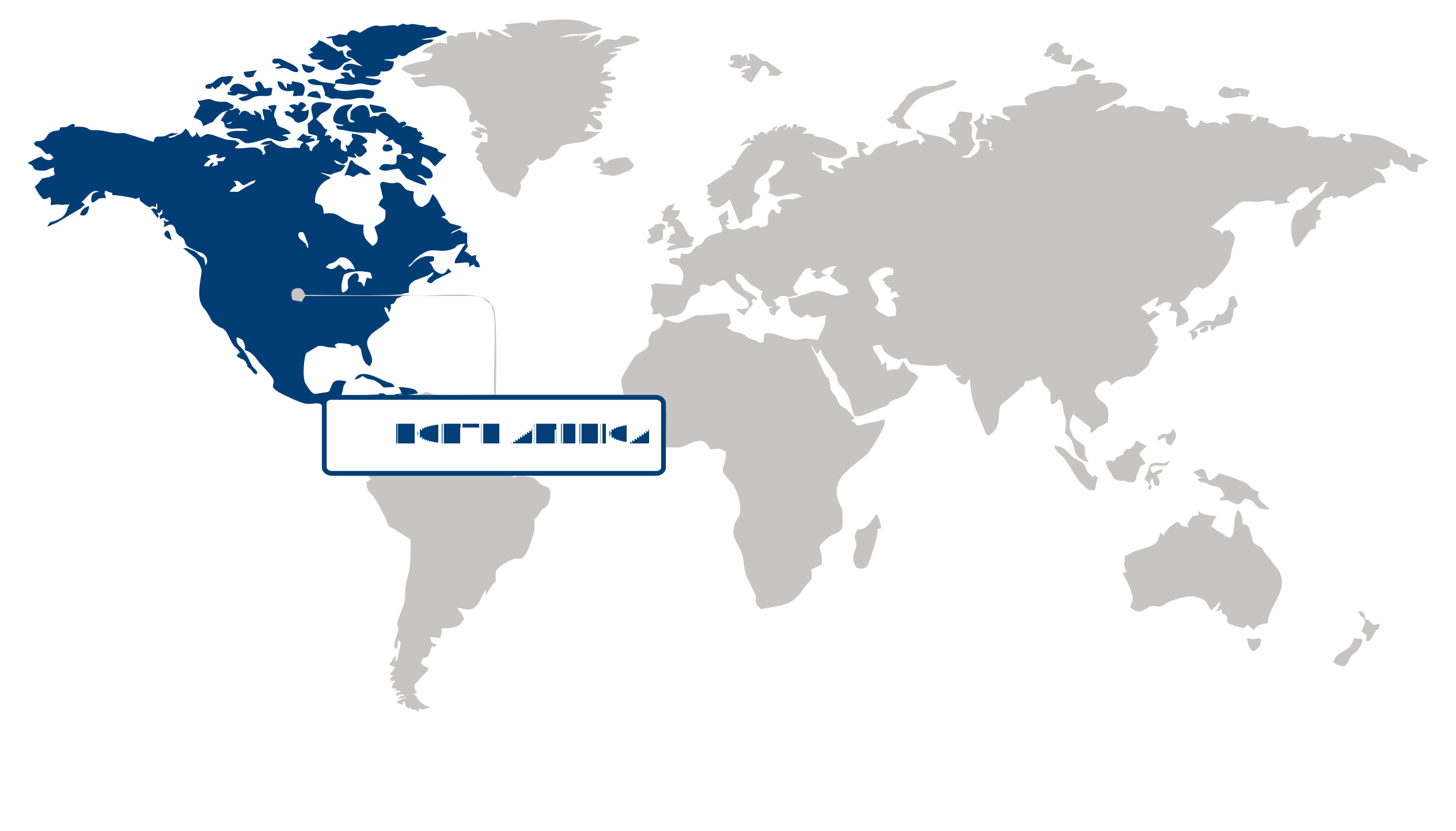
North America dominated the commercial satellite imaging market in 2025, representing more than 38.7% of the global share. This predominance is driven by substantial government and private investments in space-based technologies and advanced geospatial infrastructure. The region benefits from diversified demand spanning defense, commercial, and environmental sectors, reinforcing its leadership position. For instance, NASA and the U.S. Department of Defense have significantly expanded satellite programs, while private firms like Maxar Technologies enhance data analytics capabilities. The evolving landscape reflects increased spending on precision agriculture, urban planning, and climate monitoring, supported by regulatory frameworks conducive to innovation. This blend of robust financing and technological sophistication positions North America to capture emerging opportunities, particularly as the digital transformation accelerates and sustainability concerns intensify demand for high-resolution imaging solutions.
The United States anchors the North American commercial satellite imaging market, commanding a leadership role through concentrated investments in space technology and sophisticated geospatial data applications. Federal initiatives, including the National Geospatial-Intelligence Agency’s expansion and SpaceX’s satellite deployment programs, show dynamic public-private synergy. The U.S. defense sector’s heightened spatial intelligence requirements, coupled with commercial enterprises’ adoption of AI-enhanced analytics, drive substantial market growth. Furthermore, NASA’s Earth Science Division supports environmental monitoring efforts, enhancing demand for timely satellite imagery. This integrated ecosystem underpins the United States’ strategic dominance, reinforcing North America’s position as a critical hub in the global commercial satellite imaging market.
Asia Pacific Market Analysis:
Asia Pacific emerged as the fastest-growing region in the commercial satellite imaging market, registering a robust CAGR of 12.9%. This growth is primarily fueled by the surge in commercial satellite launches coupled with rising demand for earth-observation data to support critical sectors such as agriculture, urban planning, and climate monitoring. Governments and private enterprises alike are leveraging satellite data to enhance precision farming, optimize urban infrastructure, and address environmental challenges. Recent initiatives by organizations such as the Japan Aerospace Exploration Agency (JAXA) and the China National Space Administration (CNSA) underscore the strategic prioritization of satellite capabilities. These developments reflect heightened investments in advanced imaging technologies and data analytics platforms, positioning Asia Pacific as a key innovation hub. Moving forward, the region's evolving digital infrastructure, combined with regulatory support for space-based applications, presents vast opportunities for sustained expansion in the commercial satellite imaging market.
Japan plays a pivotal role in Asia Pacific’s commercial satellite imaging market, driven by its sophisticated aerospace capabilities and strong policy focus on technological innovation. The country’s commitment to enhancing earth-observation data utilization across agriculture and disaster management has led to frequent launches of commercial satellites, including those by Mitsubishi Electric Corporation. Moreover, Japan’s precision agriculture sector increasingly relies on satellite imagery for crop health monitoring and yield optimization, supported by the Ministry of Agriculture, Forestry and Fisheries’ initiatives. This environment fosters a competitive landscape that encourages private-sector collaboration, enhancing data accuracy and accessibility. Japan’s advanced technological base and proactive adoption of satellite data amplify Asia Pacific’s regional momentum, reinforcing its leadership position in this market.
China significantly contributes to the region’s rapid growth in the commercial satellite imaging market through its expansive satellite deployment and integration of earth-observation data into urban planning and environmental policies. The country’s Belt and Road Space Information Corridor initiative highlights China’s dedication to expanding spatial data infrastructures, facilitating better resource management and sustainable development. The People's Liberation Army's dual-use satellite systems also boost commercial applications, optimizing land use and climate resilience efforts at local and national levels. Industry leaders such as Chang Guang Satellite Technology Co. have accelerated technology commercialization by providing high-resolution imaging services domestically and globally. China’s scale, backed by substantial governmental funding and a vibrant satellite ecosystem, strengthens Asia Pacific’s market prospects, underscoring the strategic advantage of regional diversification and innovation in commercial satellite imaging.
Europe Market Trends:
Europe maintained notable presence in the commercial satellite imaging market, driven by its advanced technological infrastructure and robust regulatory frameworks fostering innovation. The region’s increasing emphasis on sustainable development and security surveillance has propelled demand for enhanced imaging capabilities, supported by European Space Agency initiatives and public-private collaborations like Airbus Defence and Space. Additionally, Europe’s digital transformation across agriculture and urban planning sectors has accelerated adoption, as reflected in the increasing funding from the European Commission toward Earth observation programs. Supply chain modernization and talent development in aerospace hubs such as Toulouse and Bremen amplify competitive positioning. These dynamics underscore Europe’s role as a strategic hub, offering significant opportunities for investors and innovators aiming to leverage sophisticated satellite imaging applications amid evolving regulatory and environmental landscapes.
Germany plays a pivotal role in Europe’s commercial satellite imaging market, exemplified by its leadership in industrial and defense-related satellite technologies. German firms such as OHB SE leverage domestic demand for precise geospatial intelligence to enhance national security and infrastructure monitoring, supported by the Bundeswehr's integration of satellite data. The country’s commitment to sustainability is further reflected in projects funded by the German Aerospace Center (DLR), promoting applications in environmental monitoring. This focus on precision and innovation positions Germany as a critical driver of European market growth, providing strategic value through its advanced technological ecosystem and government-backed initiatives enhancing satellite imaging capabilities.
France represents a key growth engine within Europe’s commercial satellite imaging market, leveraging its strong aerospace sector and space agency CNES’s investments in high-resolution imaging satellites. French companies such as Thales Alenia Space emphasize dual-use technologies that address both civilian and defense requirements, benefiting from favorable regulatory policies encouraging collaboration across sectors. France’s adoption of satellite imaging in agriculture supports precision farming and water management, augmenting market demand. These efforts, coupled with integration into European Union space programs, reinforce France's strategic importance, serving as a nexus for innovation that significantly contributes to Europe’s expanding commercial satellite imaging opportunities.
| Parameter | North America | Asia Pacific | Europe | Latin America | MEA |
|---|---|---|---|---|---|
| Innovation Hub i Scale Nascent Developing Advanced | |||||
| Cost-Sensitive Region i Scale Low Medium High | |||||
| Regulatory Environment i Scale Restrictive Neutral Supportive | |||||
| Demand Drivers i Scale Weak Moderate Strong | |||||
| Development Stage i Scale Emerging Developing Developed | |||||
| Adoption Rate i Scale Low Medium High | |||||
| New Entrants / Startups i Scale Sparse Moderate Dense | |||||
| Macro Indicators i Scale Weak Stable Strong |
Segment Leadership and Growth Trends
Commercial Satellite Imaging Market Share (%), by Application, 2026
Go beyond the chart, access full insights & data tables
Request Free Sample ReportGeospatial data acquisition & mapping held the largest share in the commercial satellite imaging market in 2025, driven by the rising need for accurate geospatial data in infrastructure and urban planning. This segment leads due to growing demand from smart city projects and precision agriculture, reflecting a shift toward data-driven decision-making and sustainable land use. Key deployments by organizations like the European Space Agency (ESA) highlight continuous advancements in satellite resolution and data processing, enhancing mapping accuracy and reliability. Strategic opportunities abound for firms offering high-resolution imaging and AI-enabled analytics, addressing public and private sector needs. Given ongoing infrastructure modernization and expanding use of geospatial intelligence in climate resilience efforts, this segment is poised to remain a central pillar of the commercial satellite imaging market.
Analysis by End-User
The government segment represented the largest share in the commercial satellite imaging market in 2025, propelled by substantial public sector investments in national mapping and environmental monitoring initiatives. Governments prioritize these services for border security, disaster response, and climate policy enforcement, supported by regulatory frameworks encouraging satellite data integration. Agencies such as NASA and the U.S. Geological Survey illustrate the segment’s reliance on accurate, up-to-date imaging to guide public infrastructure and conservation projects. Competitive dynamics favor vendors who can navigate procurement complexities and deliver scalable solutions. With rising geopolitical tensions and extensive environmental monitoring needs, the government segment will maintain strategic relevance, continually demanding enhanced imaging capabilities and broad data accessibility.
| Segment | Sub-Segment | Largest Segment | Fastest Growing |
|---|---|---|---|
| Application | Geospatial Data Acquisition & Mapping, Urban Planning & Development, Disaster Management, Energy & Natural Resource Management, Surveillance & Security, Others | ||
| End-User | Government, Defense, Forestry & Agriculture, Energy, Civil Engineering & Archaeology, Commercial Enterprises, Others |
Unlock insights tailored to your business with our bespoke market research solutions.
Click to get your customized report now.
Competitive Landscape and Market Positioning
The competitive environment is marked by concerted efforts to enhance data accuracy, revisit frequency, and analytics integration. Collaborations between satellite operators and AI-driven analytics firms amplify value propositions, as seen in strategic alignments involving Planet Labs and BlackSky. Investments in SAR technology and small satellite constellations, particularly by ICEYE and Capella Space, fortify market positioning amid rising demand for all-weather monitoring. Cross-border partnerships facilitate regional expansion, while acquisitions boost service depth and operational scale. Continuous deployment of next-generation satellites underscores a race to deliver real-time, actionable intelligence, intensifying competitive dynamics and fostering innovation at a rapid pace.
Strategic / Actionable Recommendations for Regional Players
In North America, strengthening interdisciplinary partnerships with cloud computing and AI analytics enterprises could enhance end-to-end service offerings, capitalizing on advanced imaging data’s full potential. Prioritizing sustainable satellite deployment may also align with increasing regulatory scrutiny and environmental considerations.
Asia Pacific players should focus on forging alliances with global technology firms and regional governments to expand satellite constellations tailored to high-growth sectors like agriculture and urban development. Embracing modular satellite designs may optimize rapid deployment and responsiveness to diverse client needs.
European entities could leverage expertise in SAR technology by deepening collaborations with research institutions and defense agencies to widen applications in environmental monitoring and security. Investing in interoperability standards and data-sharing frameworks may strengthen their competitive positioning vis-à-vis North American and Asian counterparts.
| Company | Market Share | Company Revenue | Revenue CAGR (%) | Product Portfolio | Geographic Presence | Innovation / R&D Focus | Strategic Developments |
|---|---|---|---|---|---|---|---|
| No companies available. | |||||||
Industry Development/News
| Company Name | Date | Key Development |
|---|
Customize Your Report
Explore examples of how this report can be tailored to different research needs, including custom segments, additional topics or chapters, and related reports. Click a section of the wheel or its numbered marker to explore the available options.
Commercial Satellite Imaging Market — Custom Segments
| Segment | Sub-Segment |
|---|---|
| No segment data available. | |
Commercial Satellite Imaging Market — Custom TOC
| Custom Chapter | Custom Details | ||
|---|---|---|---|
| No custom TOC data available. | |||
Need a different cut of the data?
Request Custom ResearchWhat is the projected value of the commercial satellite imaging industry by 2035?
Which global region commands the highest percentage of the commercial satellite imaging market?
Where has the commercial satellite imaging sector recorded the sharpest year-over-year increase?
Which is the largest sub-segment within the application segment for commercial satellite imaging industry?
Why does government sub-segment dominate the end-user segment of commercial satellite imaging sector?
What are the prominent companies operating in the commercial satellite imaging landscape?
Our Clients
"The reports offered a comprehensive view of the Food and Beverage landscape, covering market trends, consumer behavior, and competitive dynamics."
Terma A/S
"Our experience in acquiring market research reports has been outstanding — the depth of analysis and actionable insights have proven invaluable."
The Aerospace Corporation
"Fundamental Business Insights demonstrated a keen understanding of our business needs, delivering reports tailored to our specific objectives."
Kongsberg Gruppen
Our Research Team & Methodology
Every Fundamental Business Insights report is built by a dedicated vertical research team, validated through a structured primary-and-secondary methodology, and reviewed for accuracy before it reaches you.
Research Team Overview
Prepared by the Aerospace & Defence Research Team
Delivery
Published
Demand
Available
Support
Trust & Compliance
Research Intelligence
Research Workflow & Quality Assurance
Data Collection
Verified information gathered through primary and secondary research.
Data Triangulation
Cross-validation using multiple independent data sources.
Forecast Modelling
Market estimates developed using historical trends and analytical models.
Analyst Validation
Findings reviewed by domain experts for accuracy and consistency.
Editorial & Quality Review
Final editorial, quality, and compliance checks before publication.
Final Publication
Released after successful completion of the internal review process.
Report Coverage
📊 Market Assessment
- Market Size & Forecast
- Market Segmentation
- Regional Analysis
- Growth Drivers & Challenges
- Market Dynamics
🏢 Competitive Intelligence
- Competitive Landscape
- Company Profiles
- Competitive Benchmarking
- Mergers & Acquisitions
- Market Share Analysis or Key Company Strategies
🔍 Strategic Analysis
- Value Chain Analysis
- Porter's Five Forces
- PESTLE Analysis
- Pricing Trends
- Supply-Demand Analysis
🚀 Future Outlook
- Technology Landscape
- Regulatory Landscape
- Investment & Funding Landscape
- Emerging Opportunities
- Future Market Outlook
Have a question about this report or need a custom scope?
Request Customization