


Drone Analytics Market Size & Growth Forecast 2027–2036, By Segments (End Use, Deployment, Application), Regional Demand Trends (North America, Asia Pacific, Europe), Key Country Insights (U.S., Japan, South Korea, Germany, France, Italy), and Competitive Landscape
Market Size and Growth Outlook
Drone Analytics Market size was valued at USD 21.95 billion in 2026 and is projected to grow at a 20.9% CAGR from 2027 to 2036, crossing USD 146.45 billion by 2036. The industry revenue for 2027 is estimated at USD 25.81 billion.
Base Year Value (2026)
USD 21.95 billion
CAGR (2027-2036)
20.90%
Forecast Year Value (2036)
USD 146.45 billion

Historical Data Period
2022-2026

Largest Region
North America

Forecast Period
2027-2036
Drone Analytics Market Intelligence Snapshot:
-
Regional Market Dynamics:
- North America leads due to early drone deployment, mature software ecosystem, and strong enterprise adoption integrating analytics into inspection, mapping, and asset monitoring workflows.
- Asia Pacific grows at 23.54% CAGR, driven by scaling drone adoption in infrastructure monitoring, agriculture, and field operations requiring cost-efficient aerial data analytics platforms.
-
Segment Momentum:
- Power & Utility accounted for 29.16% of the market in 2026 because recurring inspection needs across widespread infrastructure make drone analytics valuable for maintenance planning, monitoring, and operational efficiency.
- On-Demand deployment is growing fastest because organizations can access analytics quickly without maintaining dedicated infrastructure, making adoption easier for project-based and variable data processing requirements.
-
Market Expansion Drivers:
- Growing infrastructure and construction digitization increasing demand for drone-based 3D analytics platforms.
- Expanding precision agriculture adoption accelerating deployment of drone-enabled crop monitoring analytics.
- Rising integration of AI-powered predictive analytics enhancing automated drone data interpretation capabilities.
-
Leading Market Participants:
Prominent players in the drone analytics market include DroneDeploy, Inc. (United States), AeroVironment, Inc. (United States), PrecisionHawk, Inc. (United States), Delta Drone SA (France), Esri, Inc. (United States), Kespry Inc. (United States), Optelos LLC (United States), Airware, Inc. (United States), HUVRdata, LLC (United States), AgEagle Aerial Systems Inc. (United States).
Global Market Forecast Snapshot:
-
Market Outlook:
- 2026 Market Size: USD 21.95 billion
- 2027 Estimated Market Size: USD 25.81 billion.
- Projected Market Size: USD 146.45 billion by 2036
- Growth Forecasts: 20.9% CAGR (2027-2036)
-
Regional and Segment Outlook:
- Leading Regional Market: North America
- High-Growth Regional Hub: Asia Pacific
- Core Revenue Segment: Power & Utility (End Use) | On-Premises (Deployment) | Thermal Detection (Application)
- Emerging Opportunity Segment: Construction & Infrastructure (End Use) | On-Demand (Deployment) | 3D Modelling (Application)
Market Growth Drivers and Industry Trends
Growing infrastructure and construction digitization increasing demand for drone-based 3D analytics platforms
The increasing digitization of infrastructure and construction workflows is driving demand in the drone analytics market as project teams seek faster and more detailed methods for surveying, mapping, and monitoring physical assets. Drone-based 3D analytics can transform aerial imagery and sensor data into detailed models of construction sites, structures, and terrain, supporting applications such as progress tracking, site measurements, asset inspection, and documentation. These capabilities can reduce reliance on time-intensive manual surveying while providing project stakeholders with visual information that can be repeatedly captured throughout different stages of development. Integration with digital construction workflows also enables drone-generated data to support planning, project coordination, quality assessment, and site management activities.
Expanding precision agriculture adoption accelerating deployment of drone-enabled crop monitoring analytics
The expansion of precision agriculture is creating stronger demand for drone-enabled monitoring solutions, which will propel the drone analytics market as farmers and agricultural operators increasingly use aerial data to understand field conditions. Drones equipped with imaging and sensing technologies can capture detailed information related to crop health, plant development, water stress, nutrient conditions, and areas requiring closer inspection. Analytics platforms can process this information to identify spatial variations across fields, allowing agricultural users to make more targeted decisions regarding irrigation, crop management, and resource allocation. The ability to monitor large agricultural areas with greater spatial detail also supports more efficient field assessment and helps integrate aerial intelligence into increasingly data-driven farming practices.
Rising integration of AI-powered predictive analytics enhancing automated drone data interpretation capabilities
The incorporation of artificial intelligence and predictive analytics is improving the ability to extract actionable information from increasingly large volumes of drone-generated data, strengthening the drone analytics market. AI-based systems can automate image classification, object detection, anomaly identification, and pattern recognition, reducing the amount of manual analysis required to interpret aerial imagery and sensor outputs. Predictive capabilities can further help identify potential infrastructure issues, changes in monitored environments, or emerging agricultural conditions by analyzing historical and real-time information. Greater automation makes drone analytics more accessible to organizations that need timely insights without maintaining extensive specialist resources for every stage of data processing.
| Growth Driver Assessment Framework | |||||
| Growth Driver | Impact On CAGR | Regulatory Influence | Geographic Relevance | Adoption Rate | Impact Timeline |
|---|---|---|---|---|---|
| Growing infrastructure and construction digitization increasing demand for drone-based 3D analytics platforms | 2.00% | Moderate | North America, Asia Pacific | High | Near Term |
| Expanding precision agriculture adoption accelerating deployment of drone-enabled crop monitoring analytics | 1.80% | Moderate | Asia Pacific, North America | High | Mid Term |
| Rising integration of AI-powered predictive analytics enhancing automated drone data interpretation capabilities | 1.50% | Low | North America, Europe | Emerging | Long Term |
Unlock insights tailored to your business with our bespoke market research solutions - Click to get your customized report now!
Regional Demand Dynamics
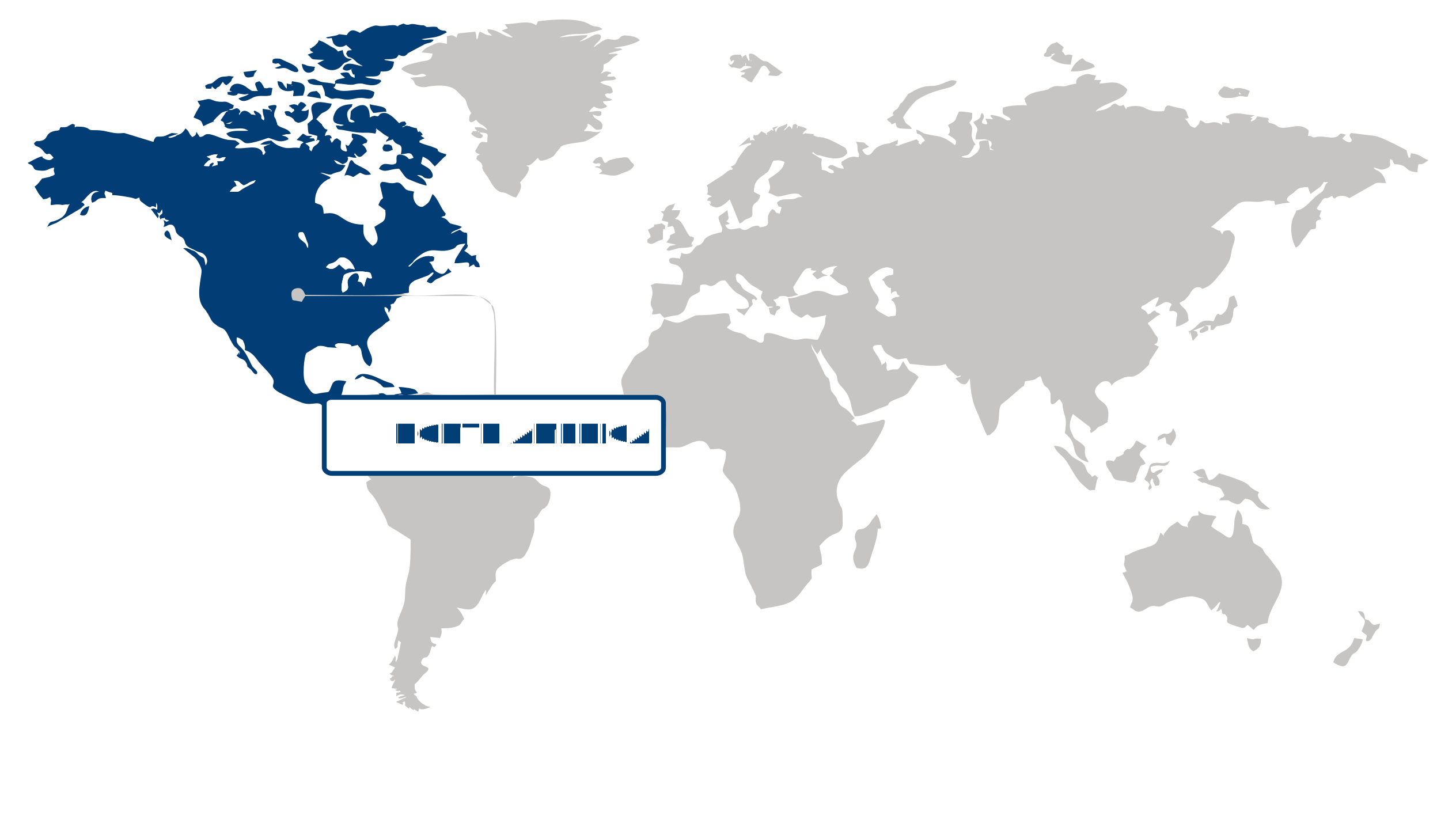
Largest Region
North America
Largest Market Share in 2026
North America (Largest Region) vs Asia Pacific (Fastest-Growing Region)
North America maintained the largest position in the drone analytics market in 2026, supported by advanced drone adoption, mature digital infrastructure, and widespread use of aerial data across commercial, industrial, and public-sector applications. The region benefits from strong integration of artificial intelligence, computer vision, cloud computing, and geospatial technologies, enabling organizations to convert drone-generated imagery into actionable operational insights. Increasing demand for asset inspection, infrastructure monitoring, precision agriculture, and security applications is further supporting the deployment of analytics solutions alongside expanding drone operations.
Asia Pacific represents the fastest-growing region in the drone analytics market, driven by expanding drone utilization across agriculture, construction, logistics, infrastructure development, and industrial inspection. Rapid urbanization and large-scale infrastructure projects are increasing demand for aerial intelligence that can improve surveying, monitoring, and operational decision-making. Improvements in drone ecosystems, digital connectivity, and regulatory frameworks are also encouraging broader commercial adoption, while growing investment in automation and smart infrastructure is creating additional demand for analytics-enabled aerial solutions.
Key Country Insights
The U.S. drone analytics market is driven by enterprise adoption across construction, energy, agriculture, and public safety. Organizations in the U.S. are integrating AI-powered analytics, cloud platforms, and automated data processing to improve operational decision-making and asset management.
Japan prioritizes drone analytics for infrastructure assessment, disaster management, and utility inspections. Market participants in Japan are enhancing automated analytics and high-resolution mapping solutions that improve inspection accuracy while reducing manual field operations.
South Korea is advancing drone analytics through AI-enabled image interpretation and smart city initiatives. Businesses in South Korea are investing in integrated geospatial platforms that support urban planning, industrial inspections, and real-time operational intelligence across multiple sectors.
Germany emphasizes drone analytics for industrial inspection, infrastructure monitoring, and manufacturing operations. Companies in Germany are expanding advanced image processing and digital asset management capabilities to support predictive maintenance and efficient facility management.
France applies drone analytics extensively for environmental monitoring, agriculture, and infrastructure management. Organizations in France are expanding advanced mapping and remote sensing capabilities to generate actionable insights that support efficient resource planning and regulatory compliance.
Italy is strengthening drone analytics adoption in surveying, cultural heritage preservation, and infrastructure inspection. Service providers in Italy are combining advanced imaging technologies with cloud-based analytics to deliver accurate spatial data for engineering and public sector projects.
Segment Leadership and Growth Trends
End Use Segment Analysis: Power & Utility (Largest Segment) vs Construction & Infrastructure (Fastest-Growing Segment)
The power & utility segment accounted for a 29.16% share in 2026, making it the largest end-use segment of the drone analytics market. The segment’s leading position is supported by the increasing use of drone-based analytics for infrastructure inspection, monitoring, and asset management. Utilities are adopting advanced aerial data solutions to improve operational efficiency, enhance maintenance planning, and support decision-making processes.
The construction & infrastructure segment is growing rapidly as companies increasingly utilize drone analytics for surveying, progress monitoring, and project management. The ability to collect accurate aerial insights and improve efficiency throughout construction workflows is encouraging adoption. Rising infrastructure development activities are further supporting growth of this segment.
Deployment Segment Analysis: On-Premises (Largest Segment) vs On-Demand (Fastest-Growing Segment)
The on-premises segment held the largest share of the drone analytics market in 2026. Organizations with strict data control requirements and complex operational environments continue to prefer on-premises deployment models. The ability to maintain internal control over data processing and analytics infrastructure supports continued adoption among enterprises.
The on-demand segment is expanding rapidly as organizations seek flexible and scalable analytics capabilities without extensive infrastructure investments. Increasing preference for accessible technology solutions and operational flexibility is encouraging adoption of on-demand deployment models.
| Report Segmentation | |||
| Segment | Sub-Segment | Largest Segment | Fastest Growing Segment |
|---|---|---|---|
| End Use | Power & Utility, Construction & Infrastructure, Oil & Gas, Agriculture, Transportation & Logistics, Others | Power & Utility | Construction & Infrastructure |
| Deployment | On-Premises, On-Demand | On-Premises | On-Demand |
| Application | Thermal Detection, Aerial Monitoring, Ground Exploration, 3D Modelling, Others | Thermal Detection | 3D Modelling |
 Read our Research Approach
Competitive Landscape and Market Positioning
Leading companies in the drone analytics market:
1. DroneDeploy Inc. (United States)
2. AeroVironment Inc. (United States)
3. PrecisionHawk Inc. (United States)
4. Delta Drone SA (France)
5. Esri Inc. (United States)
6. Kespry Inc. (United States)
7. Optelos LLC (United States)
8. Airware Inc. (United States)
9. HUVRdata LLC (United States)
10. AgEagle Aerial Systems Inc. (United States)
The drone analytics market is expanding rapidly as organizations increasingly rely on aerial data insights for operational decision-making. Companies are strengthening capabilities through advanced data processing tools, improved visualization platforms, and AI-powered analytics systems. Growing integration of drone data into industrial workflows is driving new application areas and encouraging continuous innovation in analytics solutions.
Industry Development/News
| Company Name | Date | Key Development |
|---|---|---|
| DroneDeploy | Oct-23 | DroneDeploy launched a unified platform integrating aerial and ground data, enabling collaborative data management across interior and exterior environments. The solution streamlines reality capture workflows and incorporates automation capabilities to enhance accuracy and accessibility of spatial insights, strengthening DroneDeploy’s position in enterprise drone analytics and construction intelligence applications. |
| Verge Aero | Oct-23 | Verge Aero introduced the Verge Aero X7 drone and upgraded its drone show product suite to improve operational performance and accessibility in aerial entertainment. The enhancements are designed to reduce entry barriers for drone-based performances while enabling more scalable and dynamic show production capabilities within the drone entertainment ecosystem. |
| AgEagle | May-22 | AgEagle enhanced its Measure Ground Control platform with upgraded technology features aimed at improving data analytics capabilities for enterprise drone operators. The improvements support broader use of autonomous drone systems across industrial applications, strengthening operational efficiency and expanding commercial use cases for drone-derived geospatial intelligence. |
| AeroVironment | Jun-22 | AeroVironment secured a USD 6,166,952 firm-fixed-price contract to supply Puma 3 AE small unmanned aircraft systems and related spares to the US Marine Corps. The contract reinforces AeroVironment’s position in defense-oriented drone systems, supporting continued deployment of small UAV technologies for reconnaissance and operational support applications. |
| DroneDeploy | Oct-23 | DroneDeploy launched a unified reality capture platform integrating aerial and ground data, including collaboration capabilities and automation through robotic systems. The solution enhances workflow efficiency and expands use cases in construction and spatial data analytics through improved integration of interior and exterior data environments. |
| Verge Aero | Oct-23 | Verge Aero introduced the X7 drone alongside enhancements to its drone show product suite, improving operational capabilities for aerial entertainment applications. The upgrades aim to reduce entry barriers and streamline production workflows in commercial drone-based performance systems. |
| AgEagle | May-22 | AgEagle introduced enhanced capabilities for its Measure Ground Control platform, improving data processing and analytics for enterprise drone users. The updates support more efficient autonomous drone operations across inspection, mapping, and industrial monitoring applications. |
Why Choose Us
Specialized Expertise: Our team comprises industry experts with a deep understanding of your market segment. We bring specialized knowledge and experience that ensures our research and consulting services are tailored to your unique needs.
Customized Solutions: We understand that every client is different. That's why we offer customized research and consulting solutions designed specifically to address your challenges and capitalize on opportunities within your industry.
Proven Results: With a track record of successful projects and satisfied clients, we have demonstrated our ability to deliver tangible results. Our case studies and testimonials speak to our effectiveness in helping clients achieve their goals.
Cutting-Edge Methodologies: We leverage the latest methodologies and technologies to gather insights and drive informed decision-making. Our innovative approach ensures that you stay ahead of the curve and gain a competitive edge in your market.
Client-Centric Approach: Your satisfaction is our top priority. We prioritize open communication, responsiveness, and transparency to ensure that we not only meet but exceed your expectations at every stage of the engagement.
Continuous Innovation: We are committed to continuous improvement and staying at the forefront of our industry. Through ongoing learning, professional development, and investment in new technologies, we ensure that our services are always evolving to meet your evolving needs.
Value for Money: Our competitive pricing and flexible engagement models ensure that you get maximum value for your investment. We are committed to delivering high-quality results that help you achieve a strong return on your investment.
Select Licence Type