


Drone Software Market Size & Growth Forecast 2027–2036, By Segments (Solution, Architecture, Deployment, Drone Type, End-use, Application, Industry Vertical), Regional Demand Trends (North America, Asia Pacific, Europe), Key Country Insights (U.S., Japan, South Korea, Germany, France, Italy), and Competitive Landscape
Market Size and Growth Outlook
Drone Software Market size stood at USD 13.17 billion in 2026 and is predicted to grow at a 15.2% CAGR from 2027 to 2036, reaching USD 54.21 billion by 2036. The industry revenue for 2027 is estimated at USD 14.86 billion.
Base Year Value (2026)
USD 13.17 billion
CAGR (2027-2036)
15.20%
Forecast Year Value (2036)
USD 54.21 billion

Historical Data Period
2022-2026

Largest Region
North America

Forecast Period
2027-2036
Drone Software Market Intelligence Snapshot:
-
Regional Market Dynamics:
- North America leads due to 36.04% share, strong commercial drone deployment, mature enterprise software ecosystem, and integration across inspection, agriculture, public safety, and logistics operations.
- Europe is growing at 20.83% CAGR as operators expand commercial applications, adopt compliance-focused mission automation platforms, and shift from pilot projects to structured drone programs.
-
Segment Momentum:
- Application software held a 63% share in 2026 because it directly supports flight planning, mapping, imaging, inspection, and mission execution, making it the primary software investment across commercial and industrial drone operations.
- System software is growing fastest as operators seek integrated control, data management, interoperability, and scalable fleet coordination across increasingly complex drone deployments.
-
Market Expansion Drivers:
- AI and machine learning integration enhancing autonomous flight control and mission accuracy.
- Drone-based logistics and delivery optimization platforms accelerating commercial deployment scaling.
- Advanced geospatial 3D mapping replacing traditional surveying in industrial operations.
-
Leading Market Participants:
Key players in the drone software market include SZ DJI Technology Co., Ltd. (China), DroneDeploy, Inc. (United States), Skydio, Inc. (United States), Pix4D SA (Switzerland), Esri, Inc. (United States), Delair SAS (France), AgEagle Aerial Systems Inc. (United States), PrecisionHawk, Inc. (United States), Skycatch, Inc. (United States), Yuneec International Co., Ltd. (China).
Global Market Forecast Snapshot:
-
Market Outlook:
- 2026 Market Size: USD 13.17 billion
- 2027 Estimated Market Size: USD 14.86 billion.
- Projected Market Size: USD 54.21 billion by 2036
- Growth Forecasts: 15.2% CAGR (2027-2036)
-
Regional and Segment Outlook:
- Leading Regional Market: North America
- High-Growth Regional Hub: Europe
- Core Revenue Segment: Application (Solution) | Open Source (Architecture) | Onboard (Deployment) | Rotary Blade (Drone Type) | Commercial (End-use) | Filming & Photography (Application) | Media and Entertainment (Industry Vertical)
- Emerging Opportunity Segment: System (Solution) | Closed Source (Architecture) | Ground-based (Deployment) | Hybrid (Drone Type) | Military (End-use) | Precision Agriculture (Application) | Logistics and Transportation (Industry Vertical)
Market Growth Drivers and Industry Trends
AI and machine learning integration enhancing autonomous flight control and mission accuracy
The integration of AI and machine learning will drive the drone software market growth by enabling autonomous systems to interpret flight conditions, optimize navigation, and execute missions with reduced human intervention. Intelligent algorithms can process information from onboard sensors and environmental inputs to support obstacle detection, route planning, flight stabilization, and dynamic decision-making. These capabilities are particularly valuable for commercial and industrial drone operations where operational precision, safety, and repeatability are essential. As drone applications become more complex, software with predictive analytics and adaptive control functions is helping operators manage missions across changing environments and operating conditions.
Drone-based logistics and delivery optimization platforms accelerating commercial deployment scaling
The expansion of commercial drone logistics will propel the drone software market as operators require specialized platforms to coordinate routes, schedules, fleet activity, and delivery operations. Software solutions can help optimize flight paths, monitor mission progress, manage multiple drones, and integrate delivery workflows with broader logistics systems. These capabilities become increasingly important as businesses move from individual drone deployments toward larger-scale commercial operations requiring centralized visibility and automated coordination. Demand for software that can support efficient fleet utilization and reliable delivery execution is therefore increasing alongside the development of drone-enabled logistics networks.
Advanced geospatial 3D mapping replacing traditional surveying in industrial operations
The adoption of drone-enabled 3D mapping will boost the drone software market demand as industrial organizations seek faster and more flexible alternatives to conventional surveying methods. Advanced software can process aerial imagery and sensor data to generate detailed three-dimensional representations of construction sites, industrial assets, mines, infrastructure, and other large or difficult-to-access environments. These digital models support measurements, site assessment, asset monitoring, and planning while reducing the need for extensive manual surveying activity. Integration of mapping, data processing, visualization, and analytical capabilities is strengthening the role of drone software in industrial geospatial workflows.
| Growth Driver Assessment Framework | |||||
| Growth Driver | Impact On CAGR | Regulatory Influence | Geographic Relevance | Adoption Rate | Impact Timeline |
|---|---|---|---|---|---|
| AI and machine learning integration enhancing autonomous flight control and mission accuracy | 2.00% | Moderate | North America, Europe | High | Near Term |
| Drone-based logistics and delivery optimization platforms accelerating commercial deployment scaling | 1.80% | Moderate | Asia Pacific, North America | Emerging | Mid Term |
| Advanced geospatial 3D mapping replacing traditional surveying in industrial operations | 1.60% | Moderate | North America, Asia Pacific | Medium | Mid Term |
Unlock insights tailored to your business with our bespoke market research solutions - Click to get your customized report now!
Regional Demand Dynamics
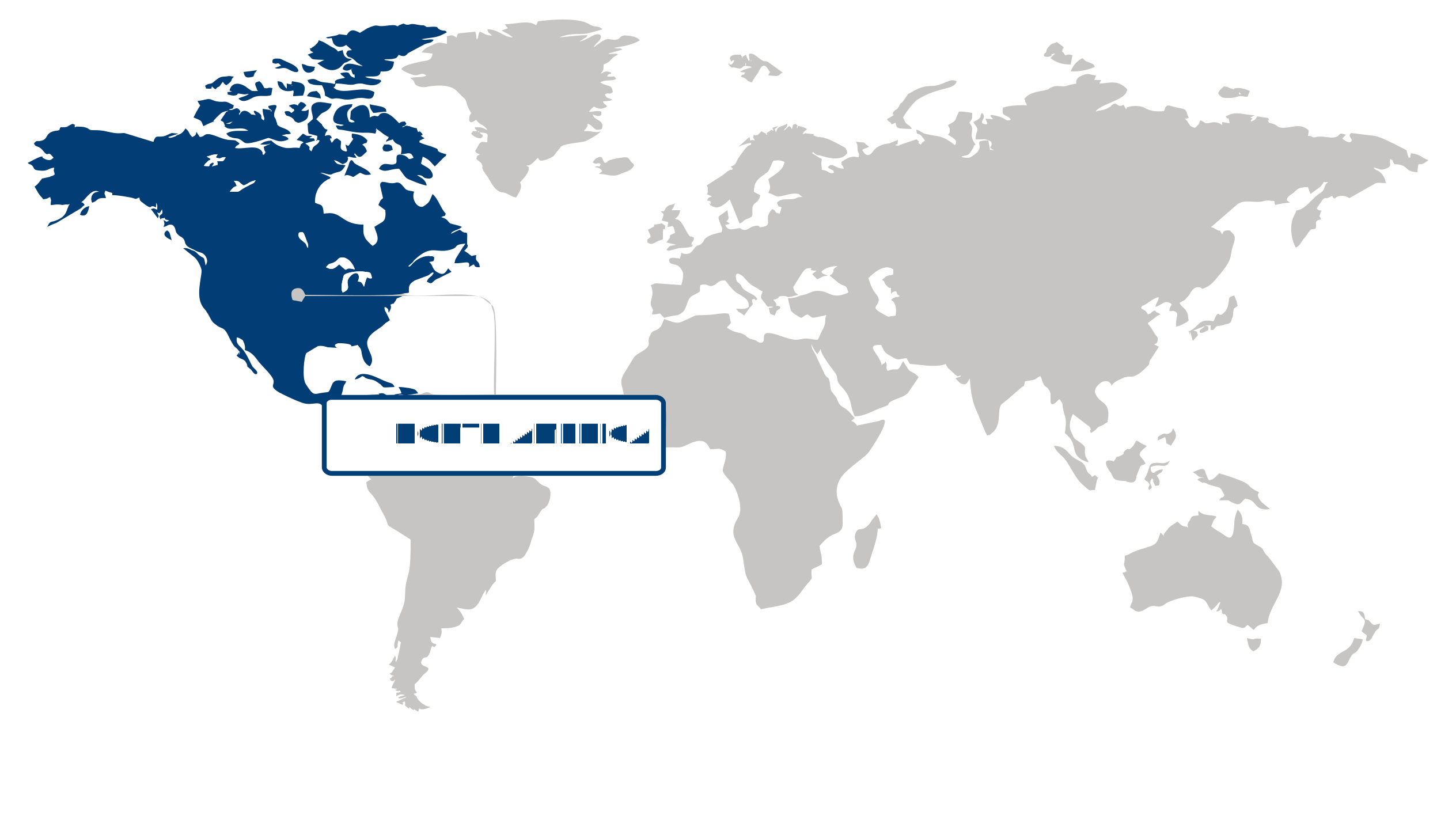
Largest Region
North America
36.04% Market Share in 2026
North America (Largest Region) vs Europe (Fastest-Growing Region)
North America accounted for the largest share of the drone software market at 36.04% in 2026, supported by advanced drone ecosystems, strong demand for autonomous aerial operations, and broad adoption across commercial, industrial, defense, and public-sector applications. The region benefits from established digital infrastructure and growing integration of software capabilities such as flight planning, fleet management, data processing, and real-time monitoring. Continued investment in unmanned aerial technologies and increasing demand for operational automation are further strengthening the regional market position.
Europe is the fastest-growing region as organizations increasingly adopt drone-based solutions for infrastructure inspection, agriculture, logistics, environmental monitoring, and public safety. Regulatory progress toward structured drone operations is supporting greater commercial use, while demand for automated data collection and remote asset monitoring is creating additional opportunities for specialized software. The region’s emphasis on digitalization, industrial efficiency, and sustainable aerial operations is also encouraging integration of drone software into broader enterprise workflows.
Key Country Insights
The U.S. drone software market emphasizes autonomous flight management, AI-enabled analytics, and scalable mission planning across commercial and public sector applications. Organizations in the U.S. continue integrating software platforms that improve operational efficiency, regulatory compliance, and real-time data utilization.
Japan advances drone software adoption for surveying, infrastructure assessment, and disaster response applications requiring reliable automation. Organizations in Japan focus on software capable of high-accuracy navigation, image processing, and seamless integration with geographic information systems.
South Korea expands the use of drone software within smart city initiatives, logistics, and infrastructure monitoring projects. Developers in South Korea enhance cloud connectivity, AI-driven flight intelligence, and fleet management capabilities to support increasingly connected drone operations.
Germany prioritizes drone software that supports industrial inspections, infrastructure monitoring, and engineering workflows. Businesses in Germany increasingly adopt platforms with advanced mapping, automated reporting, and secure data management to enhance operational accuracy across asset-intensive industries.
France promotes drone software solutions that simplify mission authorization, operational planning, and secure data handling for commercial operators. Companies in France increasingly invest in platforms that combine compliance management with advanced analytics to improve deployment efficiency across diverse industries.
Italy adopts drone software to strengthen inspection, agriculture, and environmental monitoring activities across public and private sectors. Organizations in Italy prioritize intuitive mission management, geospatial analytics, and scalable reporting tools that improve field productivity and operational oversight.
Segment Leadership and Growth Trends
Solution Segment Analysis: Application (Largest Segment) vs System (Fastest-Growing Segment)
Application solutions accounted for the largest share of 63% in 2026 in the drone software market, reflecting the growing importance of software applications that support specific drone operations and use cases. These applications can facilitate mission planning, flight management, data processing, monitoring, and other operational activities, helping users derive greater value from drone deployments. As drone adoption expands across commercial and industrial applications, demand for specialized software that simplifies operations and improves the usability of drone-generated data is supporting the segment's strong position.
The system segment is growing at the fastest pace as drone operators increasingly require integrated software environments capable of coordinating multiple aspects of drone operations. System-level solutions can support communication, control, data management, and integration across broader drone ecosystems, enabling more efficient and coordinated deployments. Increasing emphasis on automation and seamless interaction between drones, software, and supporting infrastructure is creating additional opportunities for system-oriented solutions.
Architecture Segment Analysis: Open Source (Largest Segment) vs Closed Source (Fastest-Growing Segment)
Open source represented the largest architecture segment in 2026 in the drone software market, supported by its flexibility, accessibility, and ability to facilitate customization. Open-source platforms can enable users and developers to adapt software capabilities to specific operational requirements while encouraging interoperability and broader technology experimentation. This flexibility is particularly valuable in an evolving drone ecosystem where users may require tailored functionality, integration with different systems, and greater control over software environments.
Closed source is the fastest-growing architecture segment as organizations increasingly prioritize controlled software environments, dedicated functionality, and stronger management of proprietary capabilities. Closed-source platforms can provide structured development and support frameworks while allowing vendors to maintain tighter control over software performance and integration. Rising demand for specialized drone applications and professionally managed technology solutions is contributing to greater adoption of closed-source architectures.
| Report Segmentation | |||
| Segment | Sub-Segment | Largest Segment | Fastest Growing Segment |
|---|---|---|---|
| Solution | System, Application | Application | System |
| Architecture | Open Source, Closed Source | Open Source | Closed Source |
| Deployment | Onboard, Ground-based | Onboard | Ground-based |
| Drone Type | Fixed Wing, Rotary Blade, Hybrid | Rotary Blade | Hybrid |
| End-use | Commercial, Consumer, Military | Commercial | Military |
| Application | Filming & Photography, Inspection & Maintenance, Mapping & Surveying, Precision Agriculture, Surveillance & Monitoring, Search & Rescue, Others | Filming & Photography | Precision Agriculture |
| Industry Vertical | Agriculture, Construction and Mining, Defense and Government, Energy and Utilities, Media and Entertainment, Logistics and Transportation, Others | Media and Entertainment | Logistics and Transportation |
 Read our Research Approach
Competitive Landscape and Market Positioning
Top players in the drone software market:
1. SZ DJI Technology Co. Ltd. (China)
2. DroneDeploy Inc. (United States)
3. Skydio Inc. (United States)
4. Pix4D SA (Switzerland)
5. Esri Inc. (United States)
6. Delair SAS (France)
7. AgEagle Aerial Systems Inc. (United States)
8. PrecisionHawk Inc. (United States)
9. Skycatch Inc. (United States)
10. Yuneec International Co. Ltd. (China)
In the drone software market, increasing demand for automated aerial intelligence and precision monitoring solutions is driving continuous platform innovation. Software developers are focusing on advanced analytics, flight automation, and real-time data processing capabilities to improve operational efficiency across industries such as agriculture, construction, and surveillance. The market is also benefiting from enhanced integration with cloud-based systems and mapping technologies, enabling more scalable and intelligent drone operations.
Industry Development/News
| Company Name | Date | Key Development |
|---|---|---|
| Shield AI | Mar-26 | Shield AI raised $1.5 billion in Series G funding and announced its intention to acquire military simulation systems provider Aechelon. The transaction expands Shield AI's defense-focused simulation and training portfolio while substantially strengthening its autonomous systems software capabilities. |
| Auterion and Airlogix | Feb-26 | Auterion and Airlogix established a German-Ukrainian joint venture to scale production of AI-guided autonomous drones. The partnership combines advanced software-driven autonomy capabilities with physical manufacturing expansion to support defense customers across Ukraine and NATO markets. |
| Auterion | Sep-25 | Auterion secured $130 million in Series B funding to accelerate the development and deployment of its AI-enabled drone software platform. The capital injection will support the expansion of its market reach and advance autonomous swarm software capabilities for defense applications. |
| Stark | Jul-25 | Stark acquired Pleno to integrate advanced autonomous flight and drone swarming capabilities into its portfolio. This acquisition expands Stark's software and operational expertise in response to intensifying demand for next-generation autonomous drone technologies in defense environments. |
| Intertek Group | Feb-26 | Intertek expanded its service portfolio through the acquisition of Aerial PV Inspection GmbH. The transaction enhances Intertek's technology-enabled aerial inspection and analytics services, strengthening its competitive positioning in drone-based industrial asset inspection. |
| ZenaTech Inc. | May-25 | ZenaTech expanded its geographic footprint in the European drone software market by opening a new regional headquarters in Dublin, Ireland. The facility supports the development and deployment of the company's cloud-based Drone-as-a-Service platform, integrating AI-powered sensor analytics for agriculture, construction, and renewable energy sectors. |
| Auterion and National Chung-Shan Institute of Science and Technology (NCSIST) | Jun-25 | Auterion partnered with Taiwan’s NCSIST to integrate AI-powered autonomy software into defense drone platforms. The collaboration enhances autonomous mission capabilities and supports ecosystem development and modernization within Taiwan’s defense sector. |
| Rheinmetall and Auterion | Feb-25 | Rheinmetall and Auterion formed a NATO-focused hardware-software partnership to develop integrated military drone solutions. The initiative combines autonomous software technologies with defense hardware platforms to accelerate deployment and interoperability across allied military forces. |
| Airbus and Primoco UAV | Feb-25 | Airbus and Primoco UAV successfully demonstrated AI-powered drone swarming and real-time collaborative intelligence capabilities during surveillance trials. The milestone highlights advancements in autonomous drone software architectures and coordinated mission execution for defense and security operations. |
| Rheinmetall and Auterion | Dec-24 | Rheinmetall and Auterion partnered to integrate AuterionOS into Rheinmetall's unmanned platforms, including Luna NG and Aladin. The collaboration establishes a unified software operating environment for multi-domain missions, accelerating the adoption of standardized, interoperable drone software architectures within NATO-aligned defense operations. |
Why Choose Us
Specialized Expertise: Our team comprises industry experts with a deep understanding of your market segment. We bring specialized knowledge and experience that ensures our research and consulting services are tailored to your unique needs.
Customized Solutions: We understand that every client is different. That's why we offer customized research and consulting solutions designed specifically to address your challenges and capitalize on opportunities within your industry.
Proven Results: With a track record of successful projects and satisfied clients, we have demonstrated our ability to deliver tangible results. Our case studies and testimonials speak to our effectiveness in helping clients achieve their goals.
Cutting-Edge Methodologies: We leverage the latest methodologies and technologies to gather insights and drive informed decision-making. Our innovative approach ensures that you stay ahead of the curve and gain a competitive edge in your market.
Client-Centric Approach: Your satisfaction is our top priority. We prioritize open communication, responsiveness, and transparency to ensure that we not only meet but exceed your expectations at every stage of the engagement.
Continuous Innovation: We are committed to continuous improvement and staying at the forefront of our industry. Through ongoing learning, professional development, and investment in new technologies, we ensure that our services are always evolving to meet your evolving needs.
Value for Money: Our competitive pricing and flexible engagement models ensure that you get maximum value for your investment. We are committed to delivering high-quality results that help you achieve a strong return on your investment.
Select Licence Type