


Geophysical Services Market Size & Growth Forecast 2027–2036, By Segments (Survey Type, End Use, Technology), Regional Demand Trends (North America, Asia Pacific, Europe), Key Country Insights (U.S., Japan, South Korea, Germany, France, Italy), and Competitive Landscape
Market Size and Growth Outlook
Geophysical Services Market size stood at USD 17.54 Billion in 2026 and is predicted to grow at 6.68% CAGR from 2027 to 2036, crossing USD 33.49 Billion by 2036. The industry revenue for 2027 is assessed at USD 18.53 Billion.
Base Year Value (2026)
USD 17.54 Billion
CAGR (2027-2036)
6.68%
Forecast Year Value (2036)
USD 33.49 Billion

Historical Data Period
2022-2026

Largest Region
North America

Forecast Period
2027-2036
Geophysical Services Market Intelligence Snapshot:
-
Regional Market Dynamics:
- North America led through established energy exploration, advanced geological capabilities, and diversified demand from oil and gas, mining, environmental assessment, and infrastructure projects.
- Asia Pacific is expanding rapidly as energy, mining, infrastructure, and domestic resource exploration increase demand for accurate subsurface assessments and advanced surveying techniques.
-
Segment Momentum:
- Land-based surveys accounted for 56.18% of the market in 2025 due to their extensive use in resource exploration, geological assessment, and infrastructure planning, delivering detailed subsurface information for informed decision-making.
- Seismic technology is expanding fastest because it provides highly detailed subsurface imaging that improves exploration accuracy, geological analysis, and resource development efficiency across exploration projects.
-
Market Expansion Drivers:
- Rising oil and gas exploration activities driving geophysical survey demand
- Expanding mineral exploration projects increasing subsurface imaging service usage
- Growth in renewable energy site assessment boosting geophysical data demand
-
Leading Market Participants:
Key companies in the geophysical services market include SLB (United States), CGG (France), Fugro N.V. (Netherlands), TGS ASA (Norway), PGS ASA (Norway), Halliburton Company (United States), Weatherford International plc (Switzerland), China Oilfield Services Limited (China), Baker Hughes Company (United States), Dawson Geophysical Company (United States)
Global Market Forecast Snapshot:
-
Market Outlook:
- 2026 Market Size: USD 17.54 Billion
- 2027 Estimated Market Size: USD 18.53 Billion
- Projected Market Size: USD 33.49 Billion by 2036
- Growth Forecasts: 6.68% CAGR (2027-2036)
-
Regional and Segment Outlook:
- Leading Regional Market: North America
- High-Growth Regional Hub: Asia Pacific
- Core Revenue Segment: Land Based (Survey Type) | Oil & Gas (End Use) | Seismic (Technology)
- Emerging Opportunity Segment: Land Based (Survey Type) | Oil & Gas (End Use) | Seismic (Technology)
Market Growth Drivers and Industry Trends
Rising oil and gas exploration activities driving geophysical survey demand
The continued search for new hydrocarbon reserves is increasing investment in exploration programs, a trend that will drive the geophysical services market growth. Energy companies rely on advanced geophysical surveys to map subsurface formations, identify prospective reservoirs, and reduce uncertainty before drilling activities begin. Techniques such as seismic, magnetic, and gravity surveys provide critical geological information that supports exploration planning while improving the accuracy of resource evaluation. As exploration projects extend into more technically challenging environments, the need for high-resolution subsurface imaging and specialized interpretation services becomes increasingly important throughout the exploration lifecycle.
Expanding mineral exploration projects increasing subsurface imaging service usage
Growing demand for mineral resources is encouraging exploration companies to intensify geological investigations, and the geophysical services market is benefiting from the wider adoption of advanced subsurface imaging technologies. Geophysical methods help identify mineralized zones, characterize underground structures, and prioritize drilling targets with greater confidence before large-scale extraction activities commence. By providing detailed information about geological formations across extensive exploration areas, these services improve resource assessment while reducing unnecessary exploration expenditure. The integration of multiple survey techniques also enables exploration teams to develop a more comprehensive understanding of complex mineral deposits and surrounding geological conditions.
Growth in renewable energy site assessment boosting geophysical data demand
Renewable energy developers increasingly depend on detailed site characterization before infrastructure construction, which will propel the geophysical services market growth. Geophysical investigations support the planning of wind farms, solar installations, geothermal projects, and related energy infrastructure by evaluating subsurface conditions, soil characteristics, and geological stability. Accurate site assessments help engineers identify suitable locations for foundations and supporting infrastructure while minimizing construction risks associated with unforeseen ground conditions. These investigations also contribute to more efficient project planning by providing reliable geological information for engineering design and environmental assessment activities.
| Growth Driver Assessment Framework | |||||
| Growth Driver | Impact On CAGR | Regulatory Influence | Geographic Relevance | Adoption Rate | Impact Timeline |
|---|---|---|---|---|---|
| Rising oil and gas exploration activities driving geophysical survey demand | 1.8% | High | Middle East, North America | High | Near Term |
| Expanding mineral exploration projects increasing subsurface imaging service usage | 1.7% | High | Africa, Asia Pacific | High | Mid Term |
| Growth in renewable energy site assessment boosting geophysical data demand | 1.6% | Moderate | Europe, North America | Emerging | Mid Term |
Unlock insights tailored to your business with our bespoke market research solutions - Click to get your customized report now!
Regional Demand Dynamics
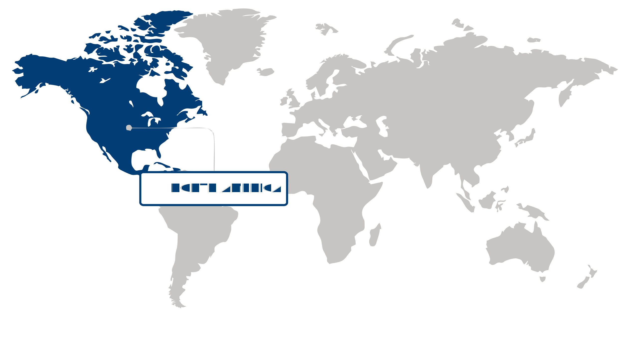
Largest Region
North America
Largest Market Share in 2026
North America (Largest Region) vs Asia Pacific (Fastest-Growing Region)
North America held the largest position in the geophysical services market in 2026, supported by established energy exploration activities, advanced geological research capabilities, and continued demand for subsurface information across infrastructure and natural resource projects. The region benefits from sophisticated geophysical technologies used to assess geological formations, identify resource opportunities, and support exploration and development decisions. Demand from oil and gas, mining, environmental assessment, and infrastructure development provides a diversified application base. Continued investment in exploration technologies and the increasing use of advanced surveying and data interpretation methods are also strengthening the role of geophysical services in improving project planning and reducing subsurface uncertainty.
Asia Pacific is anticipated to be the fastest-growing regional market, supported by expanding energy and mining activities, infrastructure development, and increasing exploration of domestic natural resources. Rapid industrialization and urban development are creating greater requirements for geological surveys to support resource identification and major construction projects. Governments and private-sector organizations are also investing in energy security and infrastructure expansion, increasing the need for accurate subsurface assessment. Greater adoption of advanced geophysical techniques is helping improve exploration efficiency and geological understanding, while expanding industrial activity across emerging economies is expected to create additional demand for specialized geophysical services.
No card data available for this language/report.
Segment Leadership and Growth Trends
Survey Type Segment Analysis: Land Based (Largest & Fastest-Growing Segment)
Land based segment dominated the geophysical services market with a 56.18% share in 2026 and also represented the fastest-growing segment, supported by its extensive application in resource exploration, geological assessment, and infrastructure development activities. Land-based surveys provide detailed information about subsurface structures and geological conditions, making them essential for exploration and planning activities. The continued requirement for accurate geological data and efficient resource identification is strengthening demand for land-based geophysical services.
End Use Segment Analysis: Oil & Gas (Largest & Fastest-Growing Segment)
Oil & gas segment led the geophysical services market in 2026 and also emerged as the fastest-growing segment, driven by the continued need for advanced exploration and reservoir assessment techniques. Geophysical services play an important role in identifying subsurface resources, improving exploration accuracy, and optimizing resource development strategies. The demand for reliable geological insights and efficient exploration methods continues to support the segment’s dominant position.
Technology Segment Analysis: Seismic (Largest & Fastest-Growing Segment)
Seismic segment accounted for the leading position in the geophysical services market in 2026 and also represented the fastest-growing segment due to its effectiveness in generating detailed subsurface images and supporting resource exploration activities. Seismic technology provides valuable geological information that helps improve decision-making during exploration and development projects. The increasing requirement for accurate subsurface analysis and improved exploration efficiency is contributing to the continued adoption of seismic-based services.
| Report Segmentation | |||
| Segment | Sub-Segment | Largest Segment | Fastest Growing Segment |
|---|---|---|---|
| Survey Type | Land Based, Marine Based, Aerial Based | Land Based | Land Based |
| End Use | Oil & Gas, Mining, Agriculture, Others | Oil & Gas | Oil & Gas |
| Technology | Seismic, Magnetic, Electromagnetic, Gradiometric, Others | Seismic | Seismic |
 Read our Research Approach
Competitive Landscape and Market Positioning
Major players in the geophysical services market:
- SLB (United States)
- CGG (France)
- Fugro N.V. (Netherlands)
- TGS ASA (Norway)
- PGS ASA (Norway)
- Halliburton Company (United States)
- Weatherford International plc (Switzerland)
- China Oilfield Services Limited (China)
- Baker Hughes Company (United States)
- Dawson Geophysical Company (United States)
Exploration priorities are shifting competitive advantage toward service providers capable of integrating advanced subsurface imaging, multi-source data interpretation, and digital analytics into unified project workflows rather than offering isolated survey capabilities. Competition increasingly reflects the ability to support complex offshore, unconventional, and energy transition projects where accuracy, environmental compliance, and operational efficiency carry equal importance. Providers with broad technical expertise and flexible deployment models are strengthening their position by delivering faster interpretation cycles and supporting clients across the entire exploration and asset evaluation process, while smaller specialists are differentiating through niche geophysical applications and region-specific operational knowledge.
Industry Development/News
| Company Name | Date | Key Development |
|---|---|---|
| Enverus | Jul-26 | Enverus acquired TGS’ North American well data products business for a total consideration exceeding $115 million. This acquisition integrates a significant commercial well log database into the company's existing energy intelligence platform, materially expanding its proprietary data assets and competitive positioning in the geophysical and subsurface intelligence sector. |
| Metatek-Group Ltd. | Jul-26 | Metatek-Group Ltd. initiated operations under its largest multi-year commercial contract to date. This long-term engagement represents a strategic expansion of the company’s geophysical service operations, providing sustained operational scale and confirming its capacity to secure and execute high-value, large-scale survey projects within its core market. |
| Tanzania Petroleum Development Corporation (TPDC) | Dec-25 | The Tanzania Petroleum Development Corporation launched the second phase of the Eyasi–Wembere exploration project. This initiative involves the acquisition of 914 kilometers of 2D seismic survey lines, representing a significant commitment to regional geophysical data collection to support ongoing oil and gas subsurface evaluation and exploration efforts. |
| PXGEO | Nov-25 | PXGEO secured two seismic acquisition contracts with Petrobras for operations in the Santos Basin, offshore Brazil. The deployment of proprietary MNode technology for these offshore geophysical surveys highlights the company's focus on advanced data acquisition capabilities and strengthens its operational footprint within the South American energy exploration sector. |
| National Grid | Sep-25 | National Grid formalized its marine survey requirements by appointing 19 suppliers to a dedicated framework agreement. This strategic move establishes a structured and scalable supplier base for the delivery of essential geophysical and geotechnical services, optimizing the company's supply chain for complex marine and infrastructure development projects. |
| Energy Geophysical Services | Mar-25 | Energy Geophysical Services acquired STRYDE’s Mini Seismic System, marking the first commercial deployment of this technology in Latin America. The adoption of this specialized equipment enhances the company’s operational capability to execute advanced seismic surveys, supporting localized energy industry applications and improving regional service offerings. |
| Amazon Web Services (AWS) | Jan-25 | AWS integrated MDIO seismic streaming from the OSDU Data Platform to accelerate AI and machine learning workflows. This technology integration enables faster seismic data processing and enhanced subsurface imaging, directly improving the efficiency, scalability, and real-time analytical capabilities of geophysical applications utilized across the energy exploration industry. |
| SLB and Viridien | Oct-24 | SLB and Viridien successfully completed joint seismic data acquisition operations in the Bonaparte Basin offshore northwest Australia. This collaborative geophysical survey provides critical subsurface intelligence, facilitating improved evaluation of underexplored areas and demonstrating the companies' combined technical capacity to manage complex offshore data acquisition projects. |
| EGS and “K” Line Wind Service | Sep-24 | EGS and “K” Line Wind Service established a joint venture, EKGS, to advance offshore geophysical survey capabilities in Japan. By integrating a dedicated geotechnical survey vessel, the partnership enhances local marine data acquisition infrastructure, specifically supporting the development and operational planning of renewable energy projects in the region. |
| China Oilfield Services Limited (COSL) | Jan-24 | COSL secured its first geophysical surveying contract in North America via a framework agreement in Mexico. This milestone represents a strategic geographic expansion and marks the company's initial entry into the North American geophysical market, enhancing its global competitive footprint and commitment to providing bespoke services in new regions. |
Why Choose Us
Specialized Expertise: Our team comprises industry experts with a deep understanding of your market segment. We bring specialized knowledge and experience that ensures our research and consulting services are tailored to your unique needs.
Customized Solutions: We understand that every client is different. That's why we offer customized research and consulting solutions designed specifically to address your challenges and capitalize on opportunities within your industry.
Proven Results: With a track record of successful projects and satisfied clients, we have demonstrated our ability to deliver tangible results. Our case studies and testimonials speak to our effectiveness in helping clients achieve their goals.
Cutting-Edge Methodologies: We leverage the latest methodologies and technologies to gather insights and drive informed decision-making. Our innovative approach ensures that you stay ahead of the curve and gain a competitive edge in your market.
Client-Centric Approach: Your satisfaction is our top priority. We prioritize open communication, responsiveness, and transparency to ensure that we not only meet but exceed your expectations at every stage of the engagement.
Continuous Innovation: We are committed to continuous improvement and staying at the forefront of our industry. Through ongoing learning, professional development, and investment in new technologies, we ensure that our services are always evolving to meet your evolving needs.
Value for Money: Our competitive pricing and flexible engagement models ensure that you get maximum value for your investment. We are committed to delivering high-quality results that help you achieve a strong return on your investment.
Select Licence Type