Satellite-Based Earth Observation Market Size & Growth Forecast 2027–2036, By Segments (Product Type, Satellite Orbit, Application, End Use, Technology), Regional Demand Trends (North America, Asia Pacific, Europe), Key Country Insights (U.S., Japan, South Korea, Germany, France, Italy), and Competitive Landscape
Jump to Content
Market Size and Growth Outlook
Satellite-Based Earth Observation Market size was around USD 4.08 billion in 2026 and is slated to grow at a 6.25% CAGR from 2027 to 2036, reaching USD 7.48 billion by 2036. The industry revenue for 2027 is calculated at USD 4.3 billion.
Get more details on this report
Request Free Sample ReportSatellite-Based Earth Observation Market Intelligence Snapshot
Regional Market Dynamics
- North America holds a 45.79% share in 2026, supported by advanced satellite infrastructure, government and defense demand, and integration of observation data with AI, cloud platforms, and analytics.
- Asia Pacific is the fastest-growing region, fueled by expanding space programs, environmental monitoring needs, and growing applications in agriculture, infrastructure planning, disaster management, and geospatial analytics.
Segment Momentum
- Value added services accounted for 62.3% of the market in 2026, driven by demand for processed imagery, geospatial analytics, and actionable intelligence that helps users make decisions without extensive in-house technical expertise.
- Environmental and climate monitoring is the fastest-growing application segment, supported by demand for consistent satellite data to track deforestation, water resources, land degradation, vegetation health, and climate-related environmental changes.
Market Expansion Drivers
- Growth in climate & environmental monitoring initiatives.
- Integration of analytics & AI with earth observation data.
- Expansion of commercial EO constellations.
Leading Market Participants
- Key players in the satellite-based earth observation market include Maxar Technologies (USA), Airbus Defence and Space (Netherlands), Planet Labs (USA), Thales Alenia Space (France), ICEYE (Finland), BlackSky (USA), Satellogic (Argentina), Spire Global (USA), MDA (Canada), ISRO Commercial Arm NSIL (India).
Global Market Forecast Snapshot
Market Outlook
- 2026 Market Size: USD 4.08 billion
- 2027 Estimated Market Size: USD 4.3 billion
- Projected Market Size: USD 7.48 billion by 2036
- Growth Forecast: 6.25% CAGR (2027-2036)
Regional and Segment Outlook
- Leading Regional Market: North America
- High-Growth Regional Hub: Asia Pacific
- Core Revenue Segment: Product Type (Value Added Services) | Satellite Orbit (Low Earth Orbit (LEO)) | Application (Defense & Intelligence) | End Use (Government & Defense) | Technology (Optical (electro Optical))
- Emerging Opportunity Segment: Product Type (Value Added Services) | Satellite Orbit (Low Earth Orbit (LEO)) | Application (Environmental & Climate Monitoring) | End Use (Commercial) | Technology (Synthetic Aperture Radar (SAR))
Market Growth Drivers and Industry Trends
Growth in climate and environmental monitoring initiatives
The growth of climate and environmental monitoring initiatives is increasing demand for satellite-based earth observation capabilities that provide broad and recurring coverage of the planet. Satellite imagery and remote sensing data are increasingly used to monitor changes in land use, ecosystems, water resources, weather-related conditions, and environmental degradation. The need for reliable information to support climate research, resource management, disaster preparedness, and environmental planning is therefore encouraging wider use of earth observation technologies.
Integration of analytics and AI with Earth observation data
The integration of advanced analytics and artificial intelligence with earth observation data is enhancing the ability to extract actionable insights from increasingly large and complex datasets. AI-based systems can assist in identifying patterns, detecting changes, classifying land and environmental features, and automating the interpretation of satellite imagery. These capabilities can reduce the time and effort required to process earth observation information, making satellite-derived intelligence more accessible for applications across environmental monitoring, agriculture, infrastructure, and disaster management.
Expansion of commercial Earth observation constellations
The expansion of commercial earth observation constellations is improving the availability, frequency, and diversity of satellite-based imagery and sensing capabilities. A larger number of satellites can support more frequent observations of specific locations, enabling users to monitor rapidly changing conditions and obtain updated information for time-sensitive applications. Increasing commercial participation is also encouraging the development of specialized sensing technologies and flexible data services, supporting broader adoption of satellite-based earth observation across public and private-sector applications.
| Growth Driver | Impact on CAGR | Regulatory Influence | Geographic Relevance | Adoption Rate | Impact Timeline |
|---|---|---|---|---|---|
| Growth in climate & environmental monitoring initiatives | 1.5% | Short term (≤ 2 yrs) | Europe; North America; spillover Asia Pacific | High | Fast |
| Integration of analytics & AI with earth observation data | 1.2% | Medium term (2–5 yrs) | North America; Europe; spillover Asia Pacific | Medium | Moderate |
| Expansion of commercial EO constellations | 1% | Long term (5+ yrs) | Asia Pacific; North America; spillover Europe | Low | Slow |
Explore Growth Opportunities
Request Free Sample ReportRegional Demand Dynamics
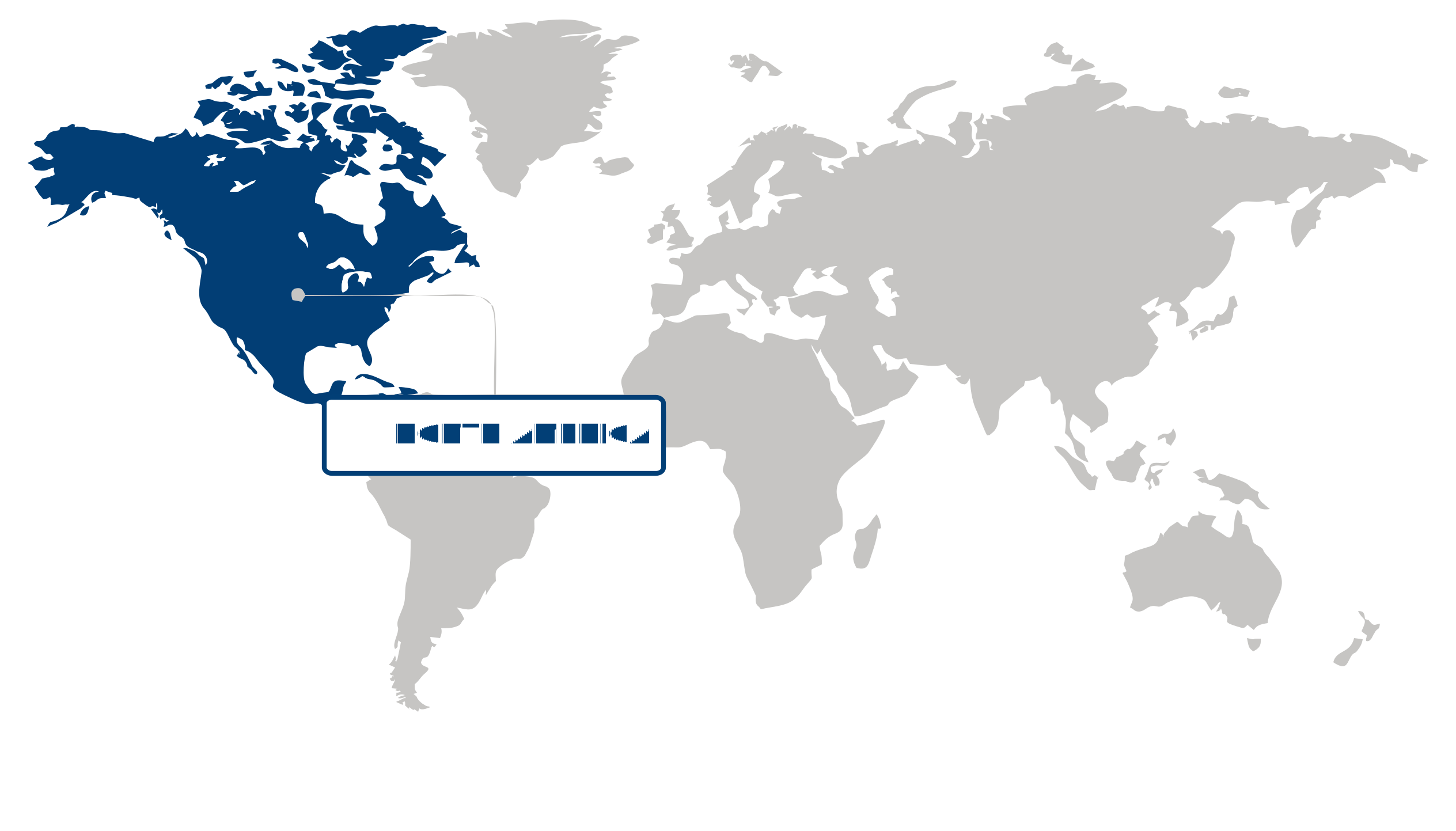
North America (Largest Region)
North America holds a 45.79% share of the satellite-based earth observation market in 2026, impelled by advanced satellite infrastructure, strong government and defense demand, and widespread adoption of geospatial intelligence across commercial applications. The region benefits from mature capabilities in satellite development, remote sensing, data processing, and analytics, enabling earth observation data to support applications ranging from environmental monitoring and disaster management to agriculture and national security. Growing demand for near-real-time intelligence is encouraging greater integration of satellite imagery with artificial intelligence, cloud platforms, and advanced analytics. Expanding commercial use of high-resolution observation data is also broadening the market beyond traditional government-led applications.
Asia Pacific (Fastest-Growing Region)
Asia Pacific is the fastest-growing region, spurred by expanding space programs, increasing demand for environmental monitoring, and rising adoption of satellite-derived data across agriculture, infrastructure, and disaster management. Governments and commercial organizations are strengthening earth observation capabilities to monitor natural resources, urban expansion, climate-related risks, and agricultural conditions. Improvements in satellite deployment, data accessibility, and geospatial analytics are making earth observation services more practical for a wider range of users. The region’s diverse environmental conditions and rapidly developing economies are further increasing the need for timely satellite intelligence, supporting sustained investment in observation infrastructure and downstream data applications.
| Parameter | North America | Asia Pacific | Europe | Latin America | MEA |
|---|---|---|---|---|---|
| Innovation HubiScaleNascentDeveloping Advanced | |||||
| Cost-Sensitive RegioniScaleLowMedium High | |||||
| Regulatory EnvironmentiScaleRestrictiveNeutral Supportive | |||||
| Demand DriversiScaleWeakModerate Strong | |||||
| Development StageiScaleEmergingDeveloping Developed | |||||
| Adoption RateiScaleLowMedium High | |||||
| New Entrants / StartupsiScaleSparseModerate Dense | |||||
| Macro IndicatorsiScaleWeakStable Strong |
Key Country Insights
United States 🇺🇸
Integrated EO EcosystemThe U.S. combines extensive satellite capabilities with strong demand across defense, climate monitoring, agriculture, mapping, and commercial analytics. Near-term priorities center on higher-resolution data, rapid revisit capabilities, cloud-based processing, and integrating Earth observation outputs into operational intelligence workflows.
Germany 🇩🇪
Industrial EO ApplicationsGermany’s satellite-based Earth observation activity is closely tied to environmental monitoring, precision agriculture, infrastructure assessment, and industrial geospatial services. Demand is increasingly oriented toward interoperable datasets, automated analytics, and actionable insights that can support climate programs and resource-management decisions.
Japan 🇯🇵
Disaster Monitoring FocusJapan places strong practical value on satellite Earth observation for disaster preparedness, environmental surveillance, land monitoring, and infrastructure management. Priorities include frequent imaging, rapid data access, and analytics capable of supporting response planning across areas exposed to earthquakes, flooding, landslides, and other natural hazards.
South Korea 🇰🇷
Smart Geospatial IntegrationSouth Korea is expanding the use of Earth observation data across national monitoring, agriculture, maritime applications, urban management, and security-related use cases. Market priorities include combining satellite imagery with AI and other geospatial data sources to improve automated detection, monitoring accuracy, and decision support.
France 🇫🇷
Climate Intelligence ApplicationsFrance’s Earth observation priorities span climate monitoring, agriculture, environmental management, defense, and maritime surveillance, supported by established space capabilities. Commercial and institutional users increasingly require reliable multispectral and radar data alongside analytics platforms that translate satellite observations into operational environmental and territorial intelligence.
Italy 🇮🇹
Infrastructure Monitoring DemandItaly presents practical demand for satellite Earth observation in infrastructure assessment, agriculture, environmental surveillance, coastal monitoring, and disaster-risk management. The market is well suited to applications using radar and optical imagery to detect land movement, monitor assets, and support more responsive territorial management.
Satellite-Based Earth Observation Market Share (%), by Product Type, 2026
Go beyond the chart, access full insights & data tables
Request Free Sample ReportProduct Type Segment Analysis: Value Added Services (Largest & Fastest-Growing Segment)
Value added services accounted for 62.3% market share in 2026 in the satellite-based earth observation market and also represents the fastest-growing product type segment, reflecting the industry's shift from supplying raw satellite imagery toward delivering processed, application-specific intelligence. Value added services can integrate imagery with data processing, analytics, visualization, geospatial intelligence, and decision-support capabilities, enabling users to extract actionable insights without requiring extensive in-house technical expertise. Growing demand for near-real-time information, automated image interpretation, and customized geospatial outputs is strengthening the commercial relevance of these services across sectors such as agriculture, infrastructure, disaster management, natural resource monitoring, and urban planning. As satellite constellations generate increasingly diverse and frequent observations, the ability to transform large volumes of remotely sensed data into usable intelligence is becoming a key differentiator, supporting continued expansion of the value added services segment.
Satellite Orbit Segment Analysis: Low Earth Orbit (LEO) (Largest & Fastest-Growing Segment)
Low earth orbit (LEO) accounted for 58.5% market share in 2026 in the satellite-based earth observation market and remains the fastest-growing satellite orbit segment. LEO satellites offer relatively short distances to the earth's surface, enabling high-resolution imaging, lower communication latency, and frequent observation opportunities that are well suited to earth observation applications. These characteristics support detailed monitoring of land use, infrastructure, agriculture, environmental conditions, and rapidly changing events. The increasing deployment of smaller and more cost-efficient satellites is also expanding the feasibility of LEO-based observation architectures, while constellation-based approaches can improve revisit frequency and geographic coverage. As users increasingly require timely and detailed geospatial information, the operational advantages of LEO are reinforcing its importance across both established and emerging earth observation applications.
Application Segment Analysis: Defense & Intelligence (Largest Segment) vs Environmental & Climate Monitoring (Fastest-Growing Segment)
Defense & intelligence accounted for 37.91% market share in 2026 in the satellite-based earth observation market, supported by the strategic importance of satellite-derived imagery and geospatial intelligence for surveillance, reconnaissance, border monitoring, situational awareness, and security planning. Earth observation satellites can provide persistent coverage across geographically dispersed or difficult-to-access areas, enabling defense and intelligence organizations to monitor changes in terrain, infrastructure, maritime activity, and other strategically relevant locations. Increasing emphasis on independent access to geospatial information and the integration of satellite observations with advanced analytics is further strengthening demand for this application. The ability to integrate frequent imagery with automated analysis and other intelligence inputs is also expanding the operational value of satellite-based earth observation for defense-related decision-making.
Environmental & climate monitoring represents the fastest-growing application segment as governments, research institutions, and commercial organizations place greater emphasis on tracking climate-related changes and environmental conditions. Satellite-based earth observation provides broad-area coverage for monitoring variables such as land degradation, deforestation, water resources, vegetation health, wildfire impacts, atmospheric conditions, and changes in ice and coastal environments. The growing need for consistent environmental datasets is increasing reliance on repeated satellite observations, particularly where ground-based monitoring is geographically limited or costly. In addition, the integration of earth observation data with advanced analytics is enabling more efficient identification of environmental trends and emerging risks, creating expanding opportunities for applications related to climate assessment, resource management, sustainability planning, and disaster preparedness.
| Segment | Sub-Segment | Largest Segment | Fastest Growing |
|---|---|---|---|
| Product Type | EO Data, Value Added Services | Value Added Services | Value Added Services |
| Satellite Orbit | Low Earth Orbit (LEO), Medium Earth Orbit (MEO), Geostationary Orbit (GEO) | Low Earth Orbit (LEO) | Low Earth Orbit (LEO) |
| Application | Agriculture & Forestry, Defense & Intelligence, Environmental & Climate Monitoring, Urban & Infrastructure Planning, Energy, Mining & Natural Resources, Maritime & Transportation, Others | Defense & Intelligence | Environmental & Climate Monitoring |
| End Use | Government & Defense, Commercial, Research & Academia, Others | Government & Defense | Commercial |
| Technology | Optical (electro Optical), Synthetic Aperture Radar (SAR), Hyperspectral & Multispectral, Thermal Infrared Sensors, LiDAR Systems, Others | Optical (electro Optical) | Synthetic Aperture Radar (SAR) |
Unlock insights tailored to your business with our bespoke market research solutions.
Click to get your customized report now.
Competitive Landscape and Market Positioning
Analyst Perspective:
Competitive differentiation in satellite-based Earth observation increasingly involves the entire data-to-insight chain rather than image acquisition alone. High-resolution optical payloads provide detailed views of land, infrastructure, and agricultural conditions, while synthetic aperture radar supports monitoring when cloud cover or limited daylight constrains optical observations. Yet resolution and nominal revisit frequency have limited value without dependable acquisition, coverage, and timely delivery. Cloud-based analytics platforms extend this proposition by simplifying data processing and translating imagery into repeatable, application-specific outputs, potentially strengthening customer retention through workflow integration. Onboard edge processing adds another dimension by prioritizing information and reducing unnecessary data transmission when downlink capacity is constrained. Its benefits must be weighed against power, thermal, and computational limitations. Providers therefore compete across complementary capabilities spanning sensing, processing, accessibility, and operational responsiveness.
Major players in the satellite-based earth observation market:
- Maxar Technologies (USA)
- Airbus Defence and Space (Netherlands)
- Planet Labs (USA)
- Thales Alenia Space (France)
- ICEYE (Finland)
- BlackSky (USA)
- Satellogic (Argentina)
- Spire Global (USA)
- MDA (Canada)
- ISRO Commercial Arm NSIL (India)
| Company | Market Share | Company Revenue | Revenue CAGR (%) | Product Portfolio | Geographic Presence | Innovation / R&D Focus | Strategic Developments |
|---|---|---|---|---|---|---|---|
| Maxar Technologies (USA) | |||||||
| Airbus Defence and Space (Netherlands) | |||||||
| Planet Labs (USA) | |||||||
| Thales Alenia Space (France) | |||||||
| ICEYE (Finland) | |||||||
| BlackSky (USA) | |||||||
| Satellogic (Argentina) | |||||||
| Spire Global (USA) | |||||||
| MDA (Canada) | |||||||
| ISRO Commercial Arm NSIL (India) |
Industry Development/News
| Company Name | Date | Key Development |
|---|---|---|
| Pixxel | December 2025 | Pixxel is leading a $145 million satellite Earth observation push in India, with its EO constellation forming part of a broader expansion of satellite-enabled agricultural intelligence. The initiative is complemented by AI-powered crop analytics from SatSure and GalaxEye, demonstrating increasing commercial deployment of satellite data for crop monitoring, weather prediction, and agricultural decision support. |
| Digantara | June 2025 | Digantara secured a major Indian Ministry of Defence deal to build a satellite network for detecting space-based spying threats. The network is planned to work with ISRO and become operational by 2026, expanding satellite-based surveillance capabilities for monitoring space activities and strengthening India's strategic use of satellite infrastructure. |
| Space42 | January 2025 | Space42 and ICEYE successfully deployed the second phase of the Foresight satellite constellation, strengthening the UAE's Earth observation and SpaceTech capabilities. The deployment expands the constellation's satellite-based observation infrastructure and represents a significant advancement in commercial SAR-based Earth observation capabilities through the companies' partnership. |
| GalaxEye | November 2024 | GalaxEye closed a $10 million Series A funding round to advance its satellite-based Earth observation business. The investment provides capital for the spacetech startup's continued development and expansion of its EO capabilities, supporting the growing commercialization of satellite-derived intelligence and observation services. |
Customize Your Report
Explore examples of how this report can be tailored to different research needs, including custom segments, additional topics or chapters, and related reports. Click a section of the wheel or its numbered marker to explore the available options.
Satellite-Based Earth Observation Market — Custom Segments
| Segment | Sub-Segment |
|---|---|
| Data Resolution | Very high resolution, High resolution, Medium resolution, Low resolution |
| Data Acquisition Frequency | On-demand acquisition, Periodic acquisition, High-frequency acquisition |
| Data Delivery Model | Raw data delivery, Processed data delivery, Analytics-ready data delivery |
Satellite-Based Earth Observation Market — Custom TOC
| Custom Chapter | Chapter Details |
|---|---|
| Geospatial Data Monetization Opportunities |
|
| Government Procurement and National Space Programs |
|
| Constellation Economics and Deployment Models |
|
Need a different cut of the data?
Request Custom ResearchFrequently Asked Questions
How big is the satellite-based earth observation market?
What is the anticipated CAGR of the satellite-based earth observation industry?
How is AI integration changing the commercial value of Earth observation data?
Why are commercial Earth observation constellations expanding deployment opportunities?
Why do value added services dominate the satellite-based earth observation market?
Why is environmental and climate monitoring becoming a major growth opportunity in satellite-based earth observation?
Why does North America dominate the satellite-based earth observation market?
What is driving rapid growth in Asia Pacific's earth observation market?
Which organizations are considered leaders in the satellite-based earth observation landscape?
Our Clients
"The reports offered a comprehensive view of the Food and Beverage landscape, covering market trends, consumer behavior, and competitive dynamics."
Terma A/S
"Our experience in acquiring market research reports has been outstanding — the depth of analysis and actionable insights have proven invaluable."
The Aerospace Corporation
"Fundamental Business Insights demonstrated a keen understanding of our business needs, delivering reports tailored to our specific objectives."
Kongsberg Gruppen
Our Research Team & Methodology
Every Fundamental Business Insights report is built by a dedicated vertical research team, validated through a structured primary-and-secondary methodology, and reviewed for accuracy before it reaches you.
This report was prepared by the Aerospace & Defence Research Team at Fundamental Business Insights, a dedicated research group specializing in global aerospace, defence, aviation, and space technology markets. The team closely tracks defense modernization programs, commercial aviation developments, aerospace manufacturing, government procurement, emerging technologies, regulatory requirements, geopolitical developments, supply chain resilience, and long-term investment trends to deliver timely and reliable market intelligence. The research is developed using a structured methodology that combines primary discussions with aerospace manufacturers, defense contractors, technology providers, component suppliers, industry experts, and other key stakeholders, along with company annual reports, government defense and aviation publications, regulatory authorities, industry associations, technical journals, and other authoritative secondary sources. Market estimates are validated through multiple research techniques, including top-down and bottom-up analysis, before undergoing an internal quality review to ensure accuracy, consistency, and methodological integrity prior to publication.
Delivery
Published
Available
Support
- Market Size & Forecast
- Market Segmentation
- Regional Analysis
- Growth Drivers & Challenges
- Market Dynamics
- Competitive Landscape
- Company Profiles
- Competitive Benchmarking
- Mergers & Acquisitions
- Market Share Analysis or Key Company Strategies
- Value Chain Analysis
- Porter's Five Forces
- PESTLE Analysis
- Pricing Trends
- Supply-Demand Analysis
- Technology Landscape
- Regulatory Landscape
- Investment & Funding Landscape
- Emerging Opportunities
- Future Market Outlook